Daly River
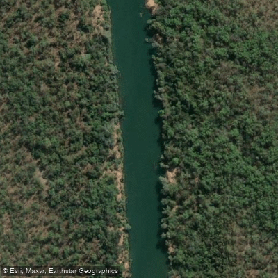
Daly River
- Boat Ramps
- 1
- Access Points
- 0
- Campsites
- 4
The Daly River is located in the Northern Territory of Australia, situated between Darwin and Katherine, just off the Stuart Highway south of Adelaide River. The drive from Darwin takes approximately 2.5 hours. Access via Woolianna Road leads to a public boat ramp, and an additional launch point at the old crossing is available when water levels are high. The river can also be reached 111 kilometres from Douglas Daly along Dorat Road, and through Litchfield National Park by four-wheel-drive during the dry season.
The Daly River system is the longest in the Northern Territory and is tidal despite being a freshwater river, eventually flowing into Anson Bay. The river is wide and carries murky water in its lower reaches, contrasting with clearer conditions upstream. The surrounding landscape features towering red cliffs, dense riparian vegetation, and sandy riverbanks. The upper sections of the river offer faster-flowing water with more challenging currents, while the lower stretches provide calmer paddling suited to those looking for a more relaxed experience.
The river is heavily associated with barramundi fishing and hosts two major annual competitions — the Barra Classic and the Barra Nationals — which can affect river traffic during those events. Paddlers should be aware that the Daly River is inhabited by crocodiles, a significant safety consideration throughout the river system. The wet season (November to April) brings monsoon rains that dramatically raise water levels and can make paddling unsafe; the dry season (May to October) is the recommended window for paddling and other water activities.
The river flows through country belonging to the Malak Malak people, who welcome recreational visitors but ask that the cultural significance of these waters be respected. Indigenous arts and crafts are available nearby at Merrepen Arts in the Nauiyu Community.
Accommodation and facilities for paddlers are available at Woolianna on the Daly Tourist Park, which sits directly on the riverbank and offers boat hire, a private boat ramp with pontoons, fish cleaning facilities, river maps, and campsite options for caravans and RVs. The river also connects downstream with the Katherine River system, and multi-day canoe tours combining the Katherine and Daly rivers are offered by at least one commercial operator, Gecko Canoeing and Trekking, as a six-day itinerary.
Water access, boat ramps & amenities
Learn how to get on Daly River. Uncover great paddling access points, boat ramps, and all the facilities you need for an unforgettable day on the water. Some locations shown may border or include private property. Always check property boundaries and applicable regulations before visiting. PaddleWays's Public & Private Land layer can help you plan your access with confidence.
Paddle smarter with real-time insights
Whether you're en route and conditions shift or you're looking for the best spot based on current flows, we enable you to make informed decisions on the fly.







Northern Territory licenses and regulations

Find Places to Paddle

Over 400,000 Places to Paddle
Every user gets free access to launch points, boat ramps, and public property parcels.


Water and weather conditions (10 day forecast)
See the best times to paddle Daly River and check the forecast before you go.
Daly River - Police Station
All Flow Stations
Paddling near Daly River
Explore Northern Territory waters
Top paddling waters
No waters available right now.
Popular Cities
Loading popular cities...
Explore near Daly River

Smarter Paddling Starts in the App.
Paddleways gives you everything you need to plan smarter, paddle better, and own every trip from first launch to takeout.