Katherine River
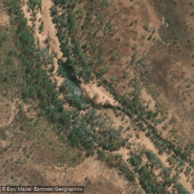
Katherine River
- Boat Ramps
- 0
- Access Points
- 0
- Campsites
- 4
The Katherine River is a 328-kilometre waterway in the Northern Territory of Australia, flowing south-west from Nitmiluk National Park through the town of Katherine before merging with the Flora River at the eastern tip of Flora River Nature Park. Together these rivers form a major tributary of the Daly River system, the longest in the NT. The river supports 38 species of fish, including barramundi, sooty grunters, and freshwater long toms, and the riparian corridor hosts archerfish, yellow-faced and northern snake-necked turtles, eagles, black cockatoos, cormorants, jabiru storks, and both freshwater and saltwater (estuarine) crocodiles.
The river divides broadly into two paddling zones. Within Nitmiluk National Park, the gorge section features dramatic sandstone cliffs and is accessible by canoe hire through Nitmiluk Tours during the dry season (June to October). Paddling is not permitted in the first gorge due to the possible presence of estuarine crocodiles; independent paddlers must portage approximately six kilometres of rocky trail to reach the second gorge. Overnight camping is available at the 4th, 6th, and 9th gorge campsites, and a permit is required from the visitor centre.
Downstream of the national park, the river runs through and west of Katherine township, offering a distinctly different experience. The typical put-in for multi-day trips is near Manbulloo Homestead, approximately 13 kilometres west of Katherine, with a common take-out at CSIRO Hole roughly 40 kilometres downstream. Three-day guided trips covering between 40 and 55 kilometres are offered by operators including Gecko Canoeing and Trekking and World Expeditions. This section features a mix of riffles, moderate rapids, and deeper pools, with named features including Dogleg Rapids, Boat Cruncher, Slippery Nipple, Crystal Rapids, and Galloping Jack. Helmets are recommended for the more technical rapids. The river flows through pandanus channels and paperbark forests, with sandy banks suitable for camping.
The dry season, roughly May to October, is the recommended paddling window. During this period the river is spring-fed by the Tindall limestone aquifer and the Oolloo Dolostone aquifer, maintaining flow at lower, more manageable levels. The wet season (November to April) brings monsoon rains that raise water levels significantly. Deep, dark waterholes should be avoided due to crocodile risk; clear, shallow, fast-flowing sections are considered safer for brief water contact.
Water access, boat ramps & amenities
Learn how to get on Katherine River. Uncover great paddling access points, boat ramps, and all the facilities you need for an unforgettable day on the water. Some locations shown may border or include private property. Always check property boundaries and applicable regulations before visiting. PaddleWays's Public & Private Land layer can help you plan your access with confidence.
Paddle smarter with real-time insights
Whether you're en route and conditions shift or you're looking for the best spot based on current flows, we enable you to make informed decisions on the fly.







Northern Territory licenses and regulations

Find Places to Paddle

Over 400,000 Places to Paddle
Every user gets free access to launch points, boat ramps, and public property parcels.


Water and weather conditions (10 day forecast)
See the best times to paddle Katherine River and check the forecast before you go.
Katherine River - Railway Bridge
All Flow Stations
Explore Northern Territory waters
Top paddling waters
No waters available right now.
Popular Cities
Loading popular cities...
Explore near Katherine River
More in Northern Territory

Smarter Paddling Starts in the App.
Paddleways gives you everything you need to plan smarter, paddle better, and own every trip from first launch to takeout.