Represa De Balbina
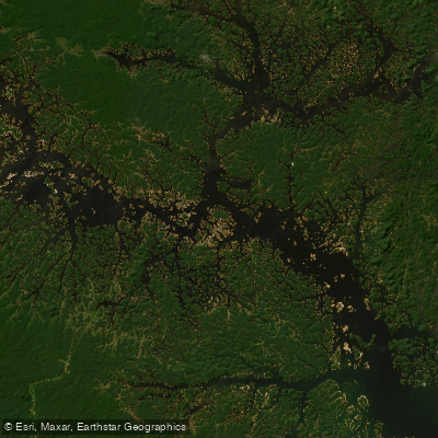
Represa De Balbina
- Boat Ramps
- 0
- Access Points
- 1
- Campsites
- 0
Represa de Balbina is a large reservoir on the Uatumã River, located approximately 170 km from Manaus in the municipality of Presidente Figueiredo, Amazonas state. Created by the Balbina hydroelectric dam, which was built between 1985 and 1989, the reservoir covers roughly 2,360 square kilometers, making it an exceptionally expansive body of water set within the Amazon rainforest.
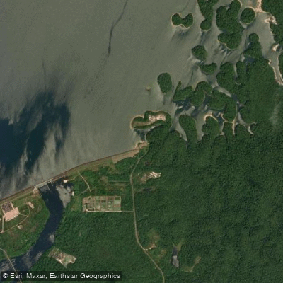
The sheer scale of the reservoir defines the paddling experience here. Access to the water typically involves traveling around 8 km by road from the town of Balbina before reaching the lake's edge, where small boats and canoes are the standard means of navigation. The low density of people on the water — a consequence of the reservoir's vast surface area — means paddlers can expect considerable solitude across much of the lake.
Wildlife interest centers heavily on fish. The reservoir supports notable populations of tucunaré (Cichla sp.), including speckled peacock bass and butterfly peacock bass, as well as silver arowana. These species proliferated after the reservoir filled and have sustained active fishing since the late 1980s. The surrounding landscape is Amazonian rainforest, and the reservoir contains numerous islands — remnants of the flooded terrain — which fishermen use as base camps and which would serve as navigational landmarks for paddlers.
The Amazon hydrological cycle, with its distinct flood and ebb seasons, influences conditions on the reservoir and affects access to various parts of the lake throughout the year. Paddlers should account for the remote character of this location, the distances involved in crossing or exploring the reservoir, and the exposure to tropical weather, including storms, that characterizes the region.
Water access, boat ramps & amenities
Learn how to get on Represa De Balbina. Uncover great paddling access points, boat ramps, and all the facilities you need for an unforgettable day on the water. Some locations shown may border or include private property. Always check property boundaries and applicable regulations before visiting. PaddleWays's Public & Private Land layer can help you plan your access with confidence.
Paddle smarter with real-time insights
Whether you're en route and conditions shift or you're looking for the best spot based on current flows, we enable you to make informed decisions on the fly.







Amazonas licenses and regulations
No licenses or regulations available for Amazonas.
Find Places to Paddle

Over 400,000 Places to Paddle
Every user gets free access to launch points, boat ramps, and public property parcels.


Water and weather conditions (10 day forecast)
See the best times to paddle Represa De Balbina and check the forecast before you go.
Uhe Pitinga Montante
All Flow Stations
Paddling near Represa De Balbina
Rio Negro
Rio Solimões
Igarapé Tarumã-Açu
Rio Puraquequara
Igarapé Santo Antônio
Rio Preto da Eva
Igarapé Água Branca
Igarapé Grande
Rio Juma
Lago Do Maçarico
Explore Amazonas waters
Top paddling waters
No waters available right now.
Popular Cities
Loading popular cities...
Explore near Represa De Balbina

Smarter Paddling Starts in the App.
Paddleways gives you everything you need to plan smarter, paddle better, and own every trip from first launch to takeout.