Rio Branco
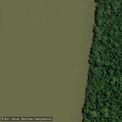
Rio Branco
- Boat Ramps
- 2
- Access Points
- 1
- Campsites
- 1
The Rio Branco is the dominant waterway of Roraima state in northern Brazil, formed just above the state capital Boa Vista by the confluence of the Rio Uraricoera, which rises in the Serra Parima along the Venezuela border, and the Rio Takutu, descending from the Serra Pakaraima on the Guyana border. From that confluence, the river follows a south-southwesterly course for approximately 775 km before joining the Rio Negro, itself a major tributary of the Amazon.
The character of the river changes significantly along its length. The upper course contains numerous rapids, making it considerably more challenging, while the lower course is easily navigable. The regularly navigated section runs roughly 440 km between Caracaraí and the mouth at the Rio Negro. Within this lower navigable segment, water depth ranges from a maximum draft of 5 metres during flood periods to a minimum of 0.7 metres during drought. Paddlers should be aware that water levels fall markedly in dry periods, which can make travel between Boa Vista and the Rio Negro difficult and may expose hazards not present at higher water.
The rivers of the region, including tributaries of the Rio Branco system, produce large sandy beaches during the summer low-water season, which can serve as campsites or rest stops. The rapids found on rivers in the northern part of the state are suitable for canoeing and other water sports. The broader hydrographic basin of the Rio Branco covers approximately 45,530 km², and virtually all river sources in Roraima originate within the state itself, draining entirely into the Amazon Basin.
Water access, boat ramps & amenities
Learn how to get on Rio Branco. Uncover great paddling access points, boat ramps, and all the facilities you need for an unforgettable day on the water. Some locations shown may border or include private property. Always check property boundaries and applicable regulations before visiting. PaddleWays's Public & Private Land layer can help you plan your access with confidence.
Paddle smarter with real-time insights
Whether you're en route and conditions shift or you're looking for the best spot based on current flows, we enable you to make informed decisions on the fly.







Roraima licenses and regulations
No licenses or regulations available for Roraima.
Find Places to Paddle

Over 400,000 Places to Paddle
Every user gets free access to launch points, boat ramps, and public property parcels.


Water and weather conditions (10 day forecast)
See the best times to paddle Rio Branco and check the forecast before you go.
Boa Vista
All Flow Stations
Paddling near Rio Branco
Explore Roraima waters
Top paddling waters
No waters available right now.
Popular Cities
Loading popular cities...
Explore near Rio Branco
Access points
Nearby waters
More in Roraima

Smarter Paddling Starts in the App.
Paddleways gives you everything you need to plan smarter, paddle better, and own every trip from first launch to takeout.