Clearwater River
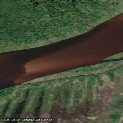
Clearwater River
- Boat Ramps
- 1
- Access Points
- 0
- Campsites
- 0
The Clearwater River in Alberta exists in two distinct paddling contexts. In the Fort McMurray region, the lower Clearwater is a Canadian Heritage River (Alberta section designated 2003), historically the final leg of the voyageur highway linking Hudson Bay to the Athabasca country. This northeastern section flows west through boreal terrain before joining the Athabasca River at Fort McMurray. The river runs wide, slow, and clear through this reach, with steady but not aggressive current. The valley is broad, with clay banks, sandstone bluffs on bends, and forested shores alternating with gravel and sandbars that provide camping opportunities. Cascade Rapids, a Class 3 feature, is the one significant whitewater obstacle on the Alberta portion; most parties portage it on a trail of roughly 1,200 metres, though experienced paddlers can run it after scouting.
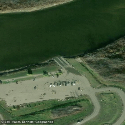
For a shorter outing near Fort McMurray, the Waterways boat launch on the south bank of the river serves as a popular put-in. The take-out is Snye Point Park in downtown Fort McMurray, where the Snye meets the Clearwater. The float covers a relaxed stretch of flatwater with steady current and no rapids, suitable for beginners and casual paddlers. Parking is available at the Waterways launch, accessed via Saline Creek Drive. Neither a Kananaskis Conservation Pass nor a Parks Canada AIS permit is required for this stretch.
In western Alberta, the Clearwater flows east from the Rockies through the foothills and into the North Saskatchewan River near Rocky Mountain House. Historical reach descriptions note that the upper section from Timber Creek to Seven Mile Flats runs approximately 48 kilometres with rapids to Grade 3, though access is rough and four-wheel drive is strongly recommended. The middle reach from Seven Mile Flats to Ricinus Bridge, roughly 53 kilometres, is characterized by swift current, tight corners, and persistent sweepers and logjams — conditions that have worsened since major floods in the mid-1990s. The lower reach from Ricinus Bridge to Rocky Mountain House is easier with fewer logjams. Paddlers considering the upper sections should be aware that widespread log hazards, including riverwide jams requiring portaging through bush and knee-deep water, make this river demanding and potentially dangerous above the Cut Off Creek and Timber Creek access points.
Water access, boat ramps & amenities
Learn how to get on Clearwater River. Uncover great paddling access points, boat ramps, and all the facilities you need for an unforgettable day on the water. Some locations shown may border or include private property. Always check property boundaries and applicable regulations before visiting. PaddleWays's Public & Private Land layer can help you plan your access with confidence.
Paddle smarter with real-time insights
Whether you're en route and conditions shift or you're looking for the best spot based on current flows, we enable you to make informed decisions on the fly.







Ab licenses and regulations
No licenses or regulations available for Ab.
Find Places to Paddle

Over 400,000 Places to Paddle
Every user gets free access to launch points, boat ramps, and public property parcels.


Water and weather conditions (10 day forecast)
See the best times to paddle Clearwater River and check the forecast before you go.
CLEARWATER RIVER AT DRAPER
All Flow Stations
Explore Ab waters
Top paddling waters
No waters available right now.
Popular Cities
Loading popular cities...
Explore near Clearwater River
Access points
More in Ab

Smarter Paddling Starts in the App.
Paddleways gives you everything you need to plan smarter, paddle better, and own every trip from first launch to takeout.