Muskeg River
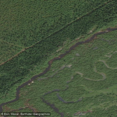
Muskeg River
- Boat Ramps
- 0
- Access Points
- 0
- Campsites
- 0
The Muskeg River in Alberta runs approximately 17 kilometres through the boreal landscape north of Fort McMurray, making it a manageable one-day paddle. The put-in is located at the PTI Camp access off the road to the Albian Mine site, north of Fort McMurray. The take-out is at the Peter Lougheed Bridge — locally referred to as the "bridge to nowhere" — on Highway 63, just past the Fort MacKay turnoff. The shuttle distance between put-in and take-out is short, keeping logistics straightforward.
The river is generally Class 1 to 2 moving water with a couple of Class 2 sections, including a notable Class 2+ play wave approximately halfway down. There is one significant hazard: a Class 3 ledge that can be portaged via a short 30-metre carry on river left. Experienced paddlers may choose to run it at appropriate water levels. Wood hazards are a consistent concern throughout the run, with sweepers and strainers present, and some steep walls along the banks mean swimmers need to be comfortable in moving water.
Water level is the primary variable governing the quality of the experience. The recommended flow range for canoes is between 15 and 25 cubic metres per second. At peak spring flows or after sustained rain, the river becomes fast and pushy with real consequences at the ledge. In late summer, low flows expose gravel bars and rocky shallows that can make the trip difficult to navigate. The spring window, when flows are in the optimal range, represents the best conditions for most paddlers.
Despite its proximity to Highway 63 and the oil sands industrial corridor — which is visible in places along the access road — the boreal landscape closes in once on the water, giving the river a relatively remote feel. The river is listed under the Peace/Slave, Buffalo and Hay paddling region of Alberta. A topographic map covering the Muskeg River area is available through Backroad Mapbooks in digital format via the Avenza Maps app, which includes paddling routes, roads, and other recreational features for trip planning purposes.
Water access, boat ramps & amenities
Learn how to get on Muskeg River. Uncover great paddling access points, boat ramps, and all the facilities you need for an unforgettable day on the water. Some locations shown may border or include private property. Always check property boundaries and applicable regulations before visiting. PaddleWays's Public & Private Land layer can help you plan your access with confidence.
Paddle smarter with real-time insights
Whether you're en route and conditions shift or you're looking for the best spot based on current flows, we enable you to make informed decisions on the fly.







Ab licenses and regulations
No licenses or regulations available for Ab.
Find Places to Paddle

Over 400,000 Places to Paddle
Every user gets free access to launch points, boat ramps, and public property parcels.


Water and weather conditions (10 day forecast)
See the best times to paddle Muskeg River and check the forecast before you go.
MUSKEG RIVER NEAR FORT MACKAY
All Flow Stations
Explore Ab waters
Top paddling waters
No waters available right now.
Popular Cities
Loading popular cities...
Explore near Muskeg River
More in Ab

Smarter Paddling Starts in the App.
Paddleways gives you everything you need to plan smarter, paddle better, and own every trip from first launch to takeout.