Musreau Lake
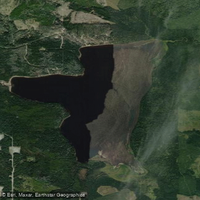
Musreau Lake
- Boat Ramps
- 0
- Access Points
- 0
- Campsites
- 1
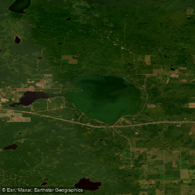
Musreau Lake is a mesotrophic lake in northwestern Alberta, located approximately 70–85 kilometres south of Grande Prairie via Highway 40, then 2–4 kilometres east on a gravel access road. The lake covers roughly 1,380 acres with a shoreline of approximately 8.6 miles, making it a moderately sized body of water well suited to a half-day or full-day paddle. The lake is spring-fed, producing clear, deep water that is notably cold even in summer. It drains via Musreau Creek to the Kakwa River and then the Smoky River. A smaller body of water, Little Musreau Lake, lies directly to the west and is connected by a short unnamed creek, both falling within the boundaries of Musreau Lake Provincial Recreation Area, established in 1978.
The primary access point for paddlers is the boat launch located in the day-use area, which was relocated in 2010 to reduce congestion near the beach. Canoes and kayaks can be launched here alongside motorized craft. Power vessels are prohibited in the beach area specifically, so paddlers should be aware of motorboat traffic elsewhere on the lake. The lakeshore trail, while unmaintained, follows the perimeter and provides a reference for paddlers exploring the shoreline. The surrounding landscape is mature boreal forest, and wildlife viewing opportunities exist throughout the area.
Fish species present in the lake include bull trout, burbot, longnose sucker, rainbow trout, and white sucker, which may be of interest to paddlers who combine fishing with their outings. The lake's clear water and forested shoreline give it a distinctly boreal character. Visitor reviews note the water is quite cold, requiring time to acclimate even during the warmest months, which is relevant for paddlers considering capsize risks.
The recreation area is most active in summer. Summer mornings tend to offer calmer water and fewer generators from the campground, while weekday visits generally mean lighter crowds. The gravel road leading to the park is frequently rough, so paddlers should plan vehicle and trailer clearance accordingly. Facilities at the day-use area include a boat launch, picnic tables, firepits, pit/vault toilets, and a water cistern. Off-highway vehicles are prohibited within the park. The name Musreau is of Cree origin, with one meaning referencing a young moose — fitting given the moose habitat in the surrounding boreal forest.
Water access, boat ramps & amenities
Learn how to get on Musreau Lake. Uncover great paddling access points, boat ramps, and all the facilities you need for an unforgettable day on the water. Some locations shown may border or include private property. Always check property boundaries and applicable regulations before visiting. PaddleWays's Public & Private Land layer can help you plan your access with confidence.
Paddle smarter with real-time insights
Whether you're en route and conditions shift or you're looking for the best spot based on current flows, we enable you to make informed decisions on the fly.







Ab licenses and regulations
No licenses or regulations available for Ab.
Find Places to Paddle

Over 400,000 Places to Paddle
Every user gets free access to launch points, boat ramps, and public property parcels.


Water and weather conditions (10 day forecast)
See the best times to paddle Musreau Lake and check the forecast before you go.
No forecast data available.
Explore Ab waters
Top paddling waters
No waters available right now.
Popular Cities
Loading popular cities...
Explore near Musreau Lake
Access points
More in Ab

Smarter Paddling Starts in the App.
Paddleways gives you everything you need to plan smarter, paddle better, and own every trip from first launch to takeout.