Nechako Reservoir
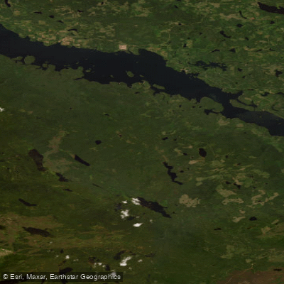
Nechako Reservoir
- Boat Ramps
- 2
- Access Points
- 2
- Campsites
- 2
The Nechako Reservoir is a large hydroelectric reservoir in British Columbia, created in 1952 when Alcan Aluminum constructed the Kenney Dam on the Nechako River. The reservoir covers approximately 890 square kilometres, stretches roughly 230 kilometres at its longest, and reaches a maximum depth of 305 metres. It sits at a surface elevation of around 850 metres, with water levels capable of swinging as much as 20 feet between 2,790 and 2,800 feet. The reservoir is composed of two broad arms connecting near the dam at the eastern end: the northern arm encompasses Ootsa and Whitesail Lakes, while the southern arm bisects Tweedsmuir Provincial Park and includes Eutsuk, Natalkuz, Knewstubb, and Tetachuck Lakes.
The primary hazard throughout the reservoir is the extensive presence of drowned trees along the shoreline and numerous barely submerged log hazards in the water. Because the area was not fully logged before flooding, dead standing timber and floating debris create genuinely dangerous conditions for paddlers. Sudden and strong winds that funnel down the lakes from the Coast Mountains compound these hazards, making conditions unpredictable. A number of channels have been cut through the dead trees to provide access to emergency landing areas, which also offer shelter from these winds.
Access to the reservoir's more remote sections is commonly done by floatplane, with Chikamin Bay and the far western end of Eutsuk Lake serving as practical starting points. Paddlers travelling eastbound on Eutsuk Lake can take advantage of prevailing winds at their backs. Accommodation options along the route include beaches, BC Parks recreation sites, and Van Tines cabins. At Chikamin Bay, a 600-metre rail portage connects Chikamin Bay with Eutsuk Lake; a mechanical winching service operates from June 15 to September 7, daily from 7 am to 5 pm. At low water in August and September, some narrow channels such as the entry to Pondosy Lake may require lining or poling boats through.
The reservoir forms the main access route to the northern region of Tweedsmuir Provincial Park, and the surrounding landscape includes the Nechako Plateau, the Quanchus Mountains, and the Coast Mountains. Wildlife viewing opportunities exist, including in the marshes visible from elevated vantage points such as the Sand Cabin Bay Lookout on Eutsuk Lake. The Tetachuk River Trail provides a 5-kilometre route from the east end of Eutsuk Lake to fishing spots and a commercial lodge.
Water access, boat ramps & amenities
Learn how to get on Nechako Reservoir. Uncover great paddling access points, boat ramps, and all the facilities you need for an unforgettable day on the water. Some locations shown may border or include private property. Always check property boundaries and applicable regulations before visiting. PaddleWays's Public & Private Land layer can help you plan your access with confidence.
Paddle smarter with real-time insights
Whether you're en route and conditions shift or you're looking for the best spot based on current flows, we enable you to make informed decisions on the fly.







Bc licenses and regulations
No licenses or regulations available for Bc.
Find Places to Paddle

Over 400,000 Places to Paddle
Every user gets free access to launch points, boat ramps, and public property parcels.


Water and weather conditions (10 day forecast)
See the best times to paddle Nechako Reservoir and check the forecast before you go.
SKINS LAKE SPILLWAY, NECHAKO RESERVOIR
All Flow Stations
Explore Bc waters
Top paddling waters
No waters available right now.
Popular Cities
Loading popular cities...
Explore near Nechako Reservoir

Smarter Paddling Starts in the App.
Paddleways gives you everything you need to plan smarter, paddle better, and own every trip from first launch to takeout.