Burntwood River
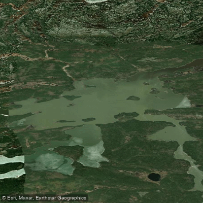
Burntwood River
- Boat Ramps
- 0
- Access Points
- 0
- Campsites
- 0
The Burntwood River in Manitoba flows northeast through the boreal shield of northern Manitoba, ultimately reaching Nelson House (Nisichawayasihk Cree Nation) on the north shore of Footprint Lake. Two primary routes are documented. The first begins via railway access between Takipy and Charles, where the Kississing River turns sharply northeast, with a put-in near small rapids by an old cabin. From there, paddlers travel roughly 15 km to Flatrock Lake before crossing approximately 60 km of Burntwood Lake to reach the river's outlet. The second route involves a float plane fly-in to File Lake from Snow Lake, Manitoba — roughly a seven-hour drive north of Winnipeg on Highway 6 — with Gogal Air Service operating the approximately 20-minute flight. This second route covers 110 km over 10 days with 9 portages totaling 1,070 m.
From the outlet of Burntwood Lake, the river runs northeast through scattered riffles past high rocky cliffs and high banks for roughly 10 miles before reaching named rapids including Carrot, Eagle, Driftwood, and Gate Falls. Carrot Rapids are described as heavy rapids requiring wading and lining on river right; there is no formal portage trail due to old burn damage, and camping at that location is poor. The upper rapids demand particular caution, as there are no maintained portage trails and currents among boulders are strong. Standing waves at the tail of some rapids can swamp a loaded canoe.
Burntwood Lake presents significant wind exposure, particularly to northwest winds, which can pin travel for hours or an entire day. The 2,000 m Burntwood Carrying Place portage begins at high ground on the left side of a small creek and involves a wet, confusing trail with misleading side trails; paddlers should allow approximately four hours for this carry.
Camping is reported as good at some of the named rapids, particularly Driftwood and Gate Falls, while the land between rapids tends to be low and less interesting. The stretch between Nelson House and Thompson is not recommended for paddling due to major hydroelectric development on that section of the river.
The takeout is at the public dock in Nelson House, accessible via Provincial Road 391 roughly 80 km west of Thompson. A supermarket is a short walk from the dock. Shuttle arrangements to Paint Lake or road transport to Thompson for rail connections are possible from Nelson House. The route is rated intermediate for both river and lake travel, with moderate portaging demands.
Water access, boat ramps & amenities
Learn how to get on Burntwood River. Uncover great paddling access points, boat ramps, and all the facilities you need for an unforgettable day on the water. Some locations shown may border or include private property. Always check property boundaries and applicable regulations before visiting. PaddleWays's Public & Private Land layer can help you plan your access with confidence.
Paddle smarter with real-time insights
Whether you're en route and conditions shift or you're looking for the best spot based on current flows, we enable you to make informed decisions on the fly.







Mb licenses and regulations
No licenses or regulations available for Mb.
Find Places to Paddle

Over 400,000 Places to Paddle
Every user gets free access to launch points, boat ramps, and public property parcels.


Water and weather conditions (10 day forecast)
See the best times to paddle Burntwood River and check the forecast before you go.
No forecast data available.
Explore Mb waters
Top paddling waters
No waters available right now.
Popular Cities
Loading popular cities...
Explore near Burntwood River

Smarter Paddling Starts in the App.
Paddleways gives you everything you need to plan smarter, paddle better, and own every trip from first launch to takeout.