Gull Pond
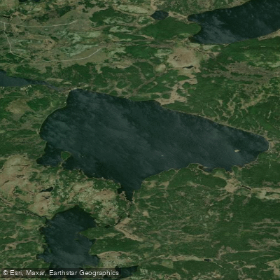
Gull Pond
- Boat Ramps
- 0
- Access Points
- 0
- Campsites
- 0
Gull Pond is located within Rotary Sunshine Park in the St. John's area of Newfoundland and Labrador, measuring approximately 1,100 metres in length. The pond features a few coves and inlets that add some variety to the paddling experience, making it a bit more interesting than some of the smaller ponds in the area.
To access the water, paddlers should park in the lots off Bennett's Road within the park. From there, it is roughly a 100-metre walk toward Thorburn Road, followed by a short trail through the woods to reach the launch point. Carrying a craft to the water is more easily managed with two people given this portage. A hiking trail runs most of the way around the pond, which provides additional egress options if needed.
The primary hazard to be aware of is submerged rocks near the shoreline — some sit just below the surface and may not be immediately visible. Paddlers should exercise caution when approaching the banks. As with any pond in the region, wind can pick up and make conditions more challenging than expected, so checking the weather before heading out is advisable.
Loons are known to nest at Gull Pond, and paddlers are encouraged to keep a respectful distance from nesting birds. The surrounding woodland setting contributes to the natural character of the pond.
Gull Pond is listed as number six among paddling destinations on the Avalon Peninsula compiled by Paddle Newfoundland and Labrador, suggesting it is a recognized and reasonably accessible option for local paddlers. The park setting and the trail around the pond make it a practical choice for those looking for a straightforward outing without extensive travel.
Water access, boat ramps & amenities
Learn how to get on Gull Pond. Uncover great paddling access points, boat ramps, and all the facilities you need for an unforgettable day on the water. Some locations shown may border or include private property. Always check property boundaries and applicable regulations before visiting. PaddleWays's Public & Private Land layer can help you plan your access with confidence.
Paddle smarter with real-time insights
Whether you're en route and conditions shift or you're looking for the best spot based on current flows, we enable you to make informed decisions on the fly.







Nl licenses and regulations
No licenses or regulations available for Nl.
Find Places to Paddle

Over 400,000 Places to Paddle
Every user gets free access to launch points, boat ramps, and public property parcels.


Water and weather conditions (10 day forecast)
See the best times to paddle Gull Pond and check the forecast before you go.
No forecast data available.
Explore Nl waters
Top paddling waters
No waters available right now.
Popular Cities
Loading popular cities...
Explore near Gull Pond

Smarter Paddling Starts in the App.
Paddleways gives you everything you need to plan smarter, paddle better, and own every trip from first launch to takeout.