Terra Nova River
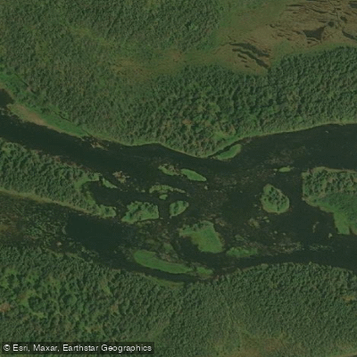
Terra Nova River
- Boat Ramps
- 0
- Access Points
- 0
- Campsites
- 0
The Terra Nova River is a technically demanding whitewater river in central Newfoundland, flowing eastward into Alexander Bay of Bonavista Bay, near the town of Glovertown. It has a well-established reputation as a serious whitewater river within the Newfoundland paddling community, and its lower section in particular is considered highly technical, demanding precision and strong boat-handling skills.
The river's typical route begins in the headwaters region — accessed by float plane to lakes such as Nanedock Lake or Newton Lake — and passes through Lake St. John, Mollyguajeck Lake (with associated falls), and Terra Nova Lake before reaching the Trans-Canada Highway, approximately 5 kilometres from the river's mouth. Key features along the route include Big Falls, Grant Falls, and a canyon section near Terra Nova village. The Trans-Canada Highway crossing at Spencer's Bridge serves as a common takeout point.
Access to the upper sections generally requires a float plane, though rough road access to Lake St. John has also been noted. The lower canyon section, in particular, has historically been paddled primarily by kayakers using short, maneuverable playboats, and completing the full run in loaded canoes is considered a significant challenge requiring precise water levels and strong technical skills.
The river passes through a landscape characterized by barrens, bogs, and boreal forest — a setting typical of central Newfoundland's interior. Water levels are an important planning consideration, as conditions that are manageable at optimal levels can become substantially more difficult otherwise.
The Terra Nova River also holds cultural significance within the Newfoundland paddling community. Paddler Jim Price was the first to run the river by kayak and co-authored a guidebook covering choice canoe and kayak routes of Newfoundland and Labrador that includes this river. The river has since been the subject of a dedicated canoe expedition film.
In addition to paddling, the river and its watershed are recognized for fly fishing, with populations of brook trout and Atlantic salmon present in the river's pools and runs.
Water access, boat ramps & amenities
Learn how to get on Terra Nova River. Uncover great paddling access points, boat ramps, and all the facilities you need for an unforgettable day on the water. Some locations shown may border or include private property. Always check property boundaries and applicable regulations before visiting. PaddleWays's Public & Private Land layer can help you plan your access with confidence.
Paddle smarter with real-time insights
Whether you're en route and conditions shift or you're looking for the best spot based on current flows, we enable you to make informed decisions on the fly.







Nl licenses and regulations
No licenses or regulations available for Nl.
Find Places to Paddle

Over 400,000 Places to Paddle
Every user gets free access to launch points, boat ramps, and public property parcels.


Water and weather conditions (10 day forecast)
See the best times to paddle Terra Nova River and check the forecast before you go.
TERRA NOVA RIVER AT GLOVERTOWN
Explore Nl waters
Top paddling waters
No waters available right now.
Popular Cities
Loading popular cities...
Explore near Terra Nova River

Smarter Paddling Starts in the App.
Paddleways gives you everything you need to plan smarter, paddle better, and own every trip from first launch to takeout.