Buffalo Lake
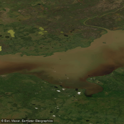
Buffalo Lake
- Boat Ramps
- 0
- Access Points
- 0
- Campsites
- 0
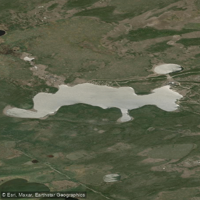
Buffalo Lake is a freshwater lake located in the Dehcho region of the Northwest Territories, Canada, at approximately 60°13′N 115°30′W. It sits within the Taiga Plains ecozone adjacent to Wood Buffalo National Park, surrounded by flat terrain characterized by peat plateaus, fens, marshes, and mixed coniferous forests dominated by black spruce, white spruce, and jack pine. The lake lies within the Ejié Túé Ndáde candidate protected area — known in English as Buffalo Lake, River and Trails — which encompasses roughly 2,180 km² in the southeastern corner of the Dehcho region, including the western portion of the lake, the Buffalo River, and extensive wetland complexes.
The primary paddling route associated with Buffalo Lake is the Buffalo River, which drains the lake and runs approximately 80 km through Wood Buffalo National Park. The water moves quickly but presents no serious rapids or portages, making it accessible to paddlers seeking a remote wilderness experience without technical whitewater challenges. Because the route passes through a National Park, motorboats are prohibited and permits are required before launching.
Access to the lake is primarily via NWT Highway 6, which leads to Little Buffalo Crossing Territorial Park, located 20 km south of Fort Resolution. From there, paddlers can travel by boat along the Little Buffalo River toward the Buffalo River. Floatplane services from Hay River also provide direct access to the lake interior; a flight for two people costs approximately $300 CAD through local operators. The take-out for the Buffalo River trip is at the bridge on Highway 5, approximately 55 km west of Hay River. Paddlers wishing to extend the trip can continue from the river's end to Great Slave Lake and follow the shoreline west back to Hay River.
The surrounding wetland complexes support abundant migratory birds and waterfowl, making birdwatching a natural complement to paddling. The river corridor is habitat for moose, caribou, bear, beaver, and muskrat. Fishing for walleye (pickerel), pike, and grayling is available along the route. Topographic maps useful for trip planning include NTS 1:250,000 sheet 85B (Buffalo Lake) and 1:50,000 sheets 85 B/6, 85 B/10, and 85 B/11.
Water access, boat ramps & amenities
Learn how to get on Buffalo Lake. Uncover great paddling access points, boat ramps, and all the facilities you need for an unforgettable day on the water. Some locations shown may border or include private property. Always check property boundaries and applicable regulations before visiting. PaddleWays's Public & Private Land layer can help you plan your access with confidence.
Paddle smarter with real-time insights
Whether you're en route and conditions shift or you're looking for the best spot based on current flows, we enable you to make informed decisions on the fly.







Nt licenses and regulations
No licenses or regulations available for Nt.
Find Places to Paddle

Over 400,000 Places to Paddle
Every user gets free access to launch points, boat ramps, and public property parcels.


Water and weather conditions (10 day forecast)
See the best times to paddle Buffalo Lake and check the forecast before you go.
No forecast data available.
Explore Nt waters
Top paddling waters
No waters available right now.
Popular Cities
Loading popular cities...
Explore near Buffalo Lake
Nearby waters
More in Nt

Smarter Paddling Starts in the App.
Paddleways gives you everything you need to plan smarter, paddle better, and own every trip from first launch to takeout.