Sandy Lake
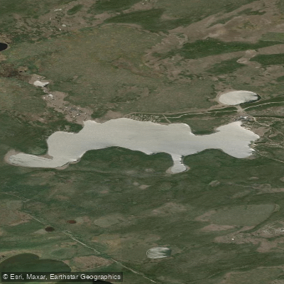
Sandy Lake
- Boat Ramps
- 0
- Access Points
- 0
- Campsites
- 0
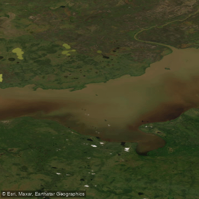
Sandy Lake sits in the remote Barrenlands of the Northwest Territories, positioned along a wilderness canoe route that connects Artillery Lake (via the Trout Creek Portage) to Whitefish Lake. The lake lies near the headwaters of the Snowdrift River, and paddlers traveling the Snowdrift system pass through Sandy Lake as they cross the height of land. Its coordinates place it at approximately 60.81°N, 105.59°W, in the Fort Smith region of the NWT.
The lake has been described by at least one traveling party as a welcome rest stop, with sandy beaches suitable for camping and exploring. Paddlers on extended wilderness trips have used it as a base for short day paddles and recovery time between longer travel days.
Those continuing downstream from Sandy Lake onto the Snowdrift River should be aware that the upper reaches of the Snowdrift below the lake have been reported as potentially too shallow for canoe navigation, depending on water levels. This is a significant logistical consideration for anyone planning to descend the Snowdrift from this point.
Sandy Lake is reached as part of a multi-portage wilderness route and is not accessible by road. The surrounding country is classic Barrenlands terrain, with eskers, tundra, and fall colours noted by travelers passing through in late summer and early autumn. Wildlife in the broader region includes Barrenland Grizzly bears, which have been observed along nearby lakes on the same route. Given the remote nature of the area and the length of typical trips through this corridor — often 60 or more days — paddlers should be fully self-sufficient and prepared for extended travel without resupply or outside contact.
Water access, boat ramps & amenities
Learn how to get on Sandy Lake. Uncover great paddling access points, boat ramps, and all the facilities you need for an unforgettable day on the water. Some locations shown may border or include private property. Always check property boundaries and applicable regulations before visiting. PaddleWays's Public & Private Land layer can help you plan your access with confidence.
Paddle smarter with real-time insights
Whether you're en route and conditions shift or you're looking for the best spot based on current flows, we enable you to make informed decisions on the fly.







Nt licenses and regulations
No licenses or regulations available for Nt.
Find Places to Paddle

Over 400,000 Places to Paddle
Every user gets free access to launch points, boat ramps, and public property parcels.


Water and weather conditions (10 day forecast)
See the best times to paddle Sandy Lake and check the forecast before you go.
No forecast data available.
Explore Nt waters
Top paddling waters
No waters available right now.
Popular Cities
Loading popular cities...
Explore near Sandy Lake
More in Nt

Smarter Paddling Starts in the App.
Paddleways gives you everything you need to plan smarter, paddle better, and own every trip from first launch to takeout.