Horton River
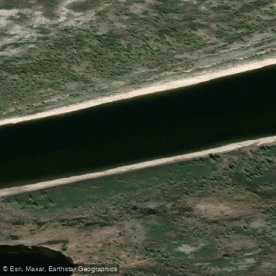
Horton River
- Boat Ramps
- 0
- Access Points
- 0
- Campsites
- 0
The Horton River runs approximately 600 kilometres from Horton Lake, near Great Bear Lake, north to Franklin Bay on the Arctic Ocean, flowing entirely above the Arctic Circle. It is considered the most northerly major river on the Canadian mainland. The full route takes between 21 and 26 days depending on conditions and layover days. Access is typically by charter floatplane from Inuvik, NWT, with Norman Wells serving as a rendezvous point for some upper-river trips.
The river divides naturally into upper and lower sections. The upper two-thirds is Class I flatwater, transitioning from boreal taiga and stunted spruce forest into open barrenlands tundra. Beginning around the 280-kilometre mark, three distinct limestone canyons introduce Class II to Class III rapids over roughly 50 kilometres. These canyons feature towers, arches, and steep cliffs that attract nesting Peregrine and Gyrfalcons. Intermediate whitewater skills are sufficient for the canyon section, though expedition-level wilderness experience is essential given the length and complete isolation of the route — there are no settlements, no road access, and no reliable communication without a satellite device.
Water clarity is exceptional through the upper river and canyon sections, with visibility to the riverbed. Below the confluence with the West River, approximately 150 kilometres from the coast, the water turns silty. The Smoking Hills region near the coast, a roughly 5,000-square-kilometre area of naturally occurring geological activity where lignite shale and magnesium cause the ground to smoulder, has been found to measurably reduce water quality in the lower Horton. Some outfitters have discontinued travel to the coast for this reason, ending trips before the river reaches the West River confluence.
Wind is the primary hazard on the lower river, where the broad channel can generate large waves capable of pinning parties in camp for days. Firewood in the form of spruce and driftwood is available along most of the route, though a naphtha stove is advisable for the treeless lower section. July is the standard paddling season.
The river corridor supports the Bluenose Caribou herd, muskoxen, grizzly bears, and arctic wolves. Fishing for lake trout, arctic grayling, and arctic char is available. Beluga whales have been observed in Franklin Bay near the river's mouth.
Water access, boat ramps & amenities
Learn how to get on Horton River. Uncover great paddling access points, boat ramps, and all the facilities you need for an unforgettable day on the water. Some locations shown may border or include private property. Always check property boundaries and applicable regulations before visiting. PaddleWays's Public & Private Land layer can help you plan your access with confidence.
Paddle smarter with real-time insights
Whether you're en route and conditions shift or you're looking for the best spot based on current flows, we enable you to make informed decisions on the fly.







Nt licenses and regulations
No licenses or regulations available for Nt.
Find Places to Paddle

Over 400,000 Places to Paddle
Every user gets free access to launch points, boat ramps, and public property parcels.


Water and weather conditions (10 day forecast)
See the best times to paddle Horton River and check the forecast before you go.
No forecast data available.
Explore Nt waters
Top paddling waters
No waters available right now.
Popular Cities
Loading popular cities...
Explore near Horton River
More in Nt

Smarter Paddling Starts in the App.
Paddleways gives you everything you need to plan smarter, paddle better, and own every trip from first launch to takeout.