Whitehills Lake
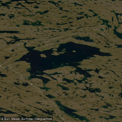
Whitehills Lake
- Boat Ramps
- 0
- Access Points
- 0
- Campsites
- 0
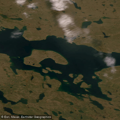
Whitehills Lake sits in Nunavut, Canada, forming a widening of the Prince River along a canoe route that circles the geographical centre of Canada between Baker Lake. The lake is accessed as part of a multi-day wilderness route, reached by paddling and tracking upstream from the Prince River bridge through a series of rapids. Heading upriver requires working against the current, wading waist-deep along the edges, portaging the steepest drops with multiple loads, and paddling hard through calmer stretches.
Ice is a significant hazard on Whitehills Lake well into the paddling season. In mid-July the lake may still be largely frozen, with only narrow leads of open water along the shoreline. These leads vary considerably — sometimes wide enough for comfortable paddling, sometimes reduced to a slot barely wider than a canoe. Where ice meets shore, paddlers may have no choice but to walk on the ice itself while pulling loaded canoes, testing each step for stability. Any breeze crossing the frozen surface drops temperatures sharply.
Inuit cabins are scattered along the lakeshore, most likely used in winter and accessed by snowmobile. Sandhill cranes are present on the open water, and Labrador tea is a notable feature of the surrounding tundra environment.
Leaving the lake, the route continues over a height of land toward Tehek Lake via a chain of portages linking small tundra ponds. There are no marked trails or established carries. Individual portages range from approximately 400 to 1,000 metres, and with six packs and a canoe, each portage requires three trips per person. Some carries extend further when the direct line proves too steep and a contour-following route adds distance. Some connecting ponds are barely large enough to paddle across before the next portage begins.
This is a remote, committing wilderness route with no facilities, no marked trails, and conditions that can remain wintry well into summer. Paddlers should be prepared for ice travel, multi-load portaging over open tundra, and the logistical demands of a fully self-supported expedition.
Water access, boat ramps & amenities
Learn how to get on Whitehills Lake. Uncover great paddling access points, boat ramps, and all the facilities you need for an unforgettable day on the water. Some locations shown may border or include private property. Always check property boundaries and applicable regulations before visiting. PaddleWays's Public & Private Land layer can help you plan your access with confidence.
Paddle smarter with real-time insights
Whether you're en route and conditions shift or you're looking for the best spot based on current flows, we enable you to make informed decisions on the fly.








Find Places to Paddle

Over 400,000 Places to Paddle
Every user gets free access to launch points, boat ramps, and public property parcels.


Water and weather conditions (10 day forecast)
See the best times to paddle Whitehills Lake and check the forecast before you go.
No forecast data available.
Explore Nu waters
Top paddling waters
No waters available right now.
Popular Cities
Loading popular cities...
Explore near Whitehills Lake
More in Nu

Smarter Paddling Starts in the App.
Paddleways gives you everything you need to plan smarter, paddle better, and own every trip from first launch to takeout.