Antelope Lake
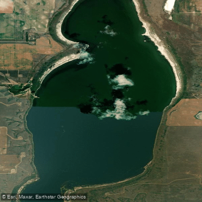
Antelope Lake
- Boat Ramps
- 0
- Access Points
- 0
- Campsites
- 0
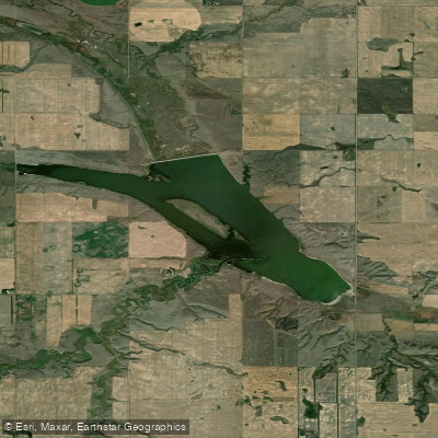
Antelope Lake is an endorheic lake in the southwest corner of Saskatchewan, covering approximately 1,512 acres with roughly 7.17 miles of shoreline. Its location within the Prairie Pothole Region of North America, inside Palliser's Triangle and the Great Plains ecoregion, gives it the characteristic open, flat prairie setting typical of this part of the province. Because it is endorheic, the lake has no natural outflow; its primary inflow is Bridge Creek, which originates to the south in the Cypress Hills at elevations exceeding 1,000 metres above sea level.
The lake sits about 43 kilometres west of Swift Current and 20 kilometres north of Gull Lake and the Trans-Canada Highway, accessible just off Highway 37. There are no communities along the shoreline, only Antelope Lake Regional Park, which occupies the adjacent land. The regional park lists a boat launch among its amenities, along with a beach area, modern washrooms with running water, potable water, showers, electrical and water hookups for camping, a concession, fish filleting station, and a sewer dump station. This makes it a reasonably well-serviced base for a paddling day trip, despite the remote feel of the surrounding landscape.
Approximately 20 kilometres southeast along the Trans-Canada Highway lies the Webb National Wildlife Area, a nature reserve that reflects the broader ecological character of the region. The open prairie setting around the lake means paddlers can expect expansive skies and minimal tree cover along the shoreline.
Within the regional park there is also a separate, smaller Antelope Lake Trout Pond, which is a stocked pond distinct from the main lake. The main lake has been stocked with walleye. Tourism Saskatchewan lists canoe and paddling among the activities associated with the regional park, confirming that paddling is a recognized use of the lake.
Water access, boat ramps & amenities
Learn how to get on Antelope Lake. Uncover great paddling access points, boat ramps, and all the facilities you need for an unforgettable day on the water. Some locations shown may border or include private property. Always check property boundaries and applicable regulations before visiting. PaddleWays's Public & Private Land layer can help you plan your access with confidence.
Paddle smarter with real-time insights
Whether you're en route and conditions shift or you're looking for the best spot based on current flows, we enable you to make informed decisions on the fly.








Find Places to Paddle

Over 400,000 Places to Paddle
Every user gets free access to launch points, boat ramps, and public property parcels.


Water and weather conditions (10 day forecast)
See the best times to paddle Antelope Lake and check the forecast before you go.
No forecast data available.
Explore Sk waters
Top paddling waters
No waters available right now.
Popular Cities
Loading popular cities...
Explore near Antelope Lake
More in Sk

Smarter Paddling Starts in the App.
Paddleways gives you everything you need to plan smarter, paddle better, and own every trip from first launch to takeout.