Highfield Reservoir
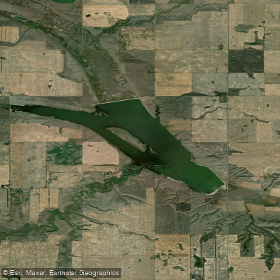
Highfield Reservoir
- Boat Ramps
- 0
- Access Points
- 0
- Campsites
- 0
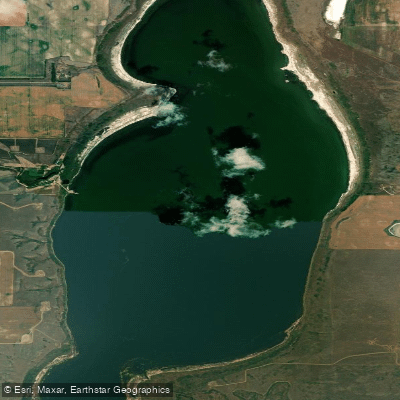
Highfield Reservoir is a medium-sized reservoir in southern Saskatchewan, situated approximately 29 kilometres east of Swift Current near Rush Lake. Constructed in 1942, it sits on Rush Lake Creek and is fed in part by the 30-kilometre Swift Current Main Canal. The reservoir covers roughly 1,073 acres with a shoreline of approximately 13.82 miles, giving paddlers a reasonable amount of water to explore.
One of the most significant practical considerations for paddlers is the absence of any official boat launch or dock. Anyone putting in will need to manage an unimproved shore access. The reservoir also experiences fluctuating water levels, as it functions primarily as a water source for the Rush Lake Irrigation project and indirectly supplies the Herbert Irrigation Project and the Town of Herbert. These fluctuations can affect shoreline conditions and accessible water depth, and paddlers should be prepared for variable conditions depending on the time of year and irrigation demands.
Water use on the reservoir is regulated: the reservoir is not to be used for domestic, farm, or industrial purposes without permission from the Water Security Agency. Paddlers should be aware of this regulatory context, though recreational paddling is not explicitly restricted.
The reservoir does support some fishing, with Northern pike being the most commonly reported species, along with Walleye and Burbot. The fishery is not stocked, primarily because the fluctuating water levels make it a less than ideal fish habitat. The surrounding landscape is consistent with southern Saskatchewan's open prairie character. Given the irrigation function of the reservoir, water levels and shoreline conditions are likely most stable outside of peak irrigation periods, though specific seasonal patterns are not well documented.
Water access, boat ramps & amenities
Learn how to get on Highfield Reservoir. Uncover great paddling access points, boat ramps, and all the facilities you need for an unforgettable day on the water. Some locations shown may border or include private property. Always check property boundaries and applicable regulations before visiting. PaddleWays's Public & Private Land layer can help you plan your access with confidence.
Paddle smarter with real-time insights
Whether you're en route and conditions shift or you're looking for the best spot based on current flows, we enable you to make informed decisions on the fly.








Find Places to Paddle

Over 400,000 Places to Paddle
Every user gets free access to launch points, boat ramps, and public property parcels.


Water and weather conditions (10 day forecast)
See the best times to paddle Highfield Reservoir and check the forecast before you go.
No forecast data available.
Explore Sk waters
Top paddling waters
No waters available right now.
Popular Cities
Loading popular cities...
Explore near Highfield Reservoir
More in Sk

Smarter Paddling Starts in the App.
Paddleways gives you everything you need to plan smarter, paddle better, and own every trip from first launch to takeout.