Klondike River
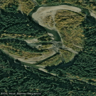
Klondike River
- Boat Ramps
- 0
- Access Points
- 0
- Campsites
- 0
The Klondike River in Yukon, Canada flows through the historic Klondike region near Dawson City, eventually joining the Yukon River just above town. The river runs roughly parallel to the Klondike Highway for much of its length, passing numerous creek and gulch confluences including Leroy, Dognose, Gilcher, Goring, Germaine, Rabbit, Hunker, Rock, and others along the way.
The primary put-in used by paddlers is at the Dempster Highway bridge, located less than one kilometre east of the Klondike Highway. Another commonly used starting point is Rock Creek, from which guided rafting tours operate down to the Yukon River at Dawson City. The take-out is at the Klondike's confluence with the Yukon River, just above Dawson City.
The river offers a relatively accessible wilderness experience suitable for a range of paddler abilities. Guided raft and canoe tours are available through local outfitters based in Dawson City, and canoe and gear rentals with transportation to and from put-in and take-out points can be arranged locally. Independent paddlers can also access the river using rented equipment.
Wildlife along the river corridor includes moose, beavers, bears, and bald and golden eagles. During late June and July, King Salmon can be observed in the water during their upstream spawning run. The river passes through undeveloped Yukon wilderness, offering views of the surrounding boreal landscape.
The Klondike River and the broader Dawson City waterway network carry significant historical and cultural importance, having served as a primary means of transportation through the Klondike region and remaining connected to the heritage of the Tr'ondëk Hwëch'in people.
For trip planning, the reference guide "A Guide to Paddling in the Yukon" by Ken Madsen and Peter Mather (Primrose Publishing, 2004) covers this route and provides additional detail for paddlers.
Water access, boat ramps & amenities
Learn how to get on Klondike River. Uncover great paddling access points, boat ramps, and all the facilities you need for an unforgettable day on the water. Some locations shown may border or include private property. Always check property boundaries and applicable regulations before visiting. PaddleWays's Public & Private Land layer can help you plan your access with confidence.
Paddle smarter with real-time insights
Whether you're en route and conditions shift or you're looking for the best spot based on current flows, we enable you to make informed decisions on the fly.







Yt licenses and regulations
No licenses or regulations available for Yt.
Find Places to Paddle

Over 400,000 Places to Paddle
Every user gets free access to launch points, boat ramps, and public property parcels.


Water and weather conditions (10 day forecast)
See the best times to paddle Klondike River and check the forecast before you go.
KLONDIKE RIVER ABOVE BONANZA CREEK
All Flow Stations
Explore Yt waters
Top paddling waters
No waters available right now.
Popular Cities
Loading popular cities...
Explore near Klondike River
Nearby waters
More in Yt

Smarter Paddling Starts in the App.
Paddleways gives you everything you need to plan smarter, paddle better, and own every trip from first launch to takeout.