Workboat Passage
- Saltwater
- Strait
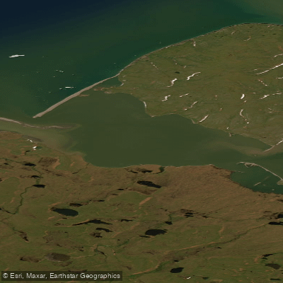
Workboat Passage
- Saltwater
- Strait
- Sq. miles
- 14
- Boat Ramps
- 0
- Access Points
- 0
- Campsites
- 0
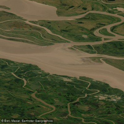
Workboat Passage is a narrow strait in the Beaufort Sea, separating Herschel Island-Qikiqtaruk from the mainland coast of Yukon within Ivvavik National Park. The passage is three kilometers wide and serves as the primary marine channel between the island and the mainland. This is a remote, high-Arctic coastal environment characterized by frigid waters, significant ice cover for much of the year, and a stark, treeless landscape. The island itself is a territorial park, National Historic Site, and a tentative UNESCO World Heritage Site, known for its historic whaling station buildings, Inuvialuit cultural sites near Simpson Point, and Ice Age fossils.
Paddling here is an expedition-level undertaking suitable only for highly experienced and self-sufficient kayakers prepared for extreme wilderness conditions. The region is normally snow-covered from September to June, with ice-free paddling conditions possible only during a brief summer window. Water temperatures remain near freezing year-round, posing a severe and immediate risk of hypothermia. The open exposure to the Beaufort Sea means winds can be strong and unpredictable, creating significant fetch and choppy or rough water conditions in the passage. There are no formal launch sites, take-outs, or facilities for paddlers; any access would require a wilderness beach landing on either the island or the mainland coast within Ivvavik National Park. The area is home to polar bears, brown bears, and muskoxen, requiring strict food storage and bear safety protocols. Boat traffic is likely minimal aside from occasional cruise ships or research vessels, but their presence in the narrow passage would require vigilance.
All paddling occurs within or adjacent to protected areas. Herschel Island-Qikiqtaruk is a Natural Environment Park, and the mainland coast is part of Ivvavik National Park. Paddlers must obtain all necessary permits and strictly adhere to park regulations, including guidelines for interacting with the abundant wildlife such as bowhead and beluga whales, ringed and bearded seals, and large colonies of migratory birds like Black Guillemots. There are no recommended routes or day trips, underscoring the need for meticulous personal trip planning and local knowledge.
Water access, boat ramps & amenities
Learn how to get on Workboat Passage. Uncover great paddling access points, boat ramps, and all the facilities you need for an unforgettable day on the water. Some locations shown may border or include private property. Always check property boundaries and applicable regulations before visiting. PaddleWays's Public & Private Land layer can help you plan your access with confidence.
Paddle smarter with real-time insights
Whether you're en route and conditions shift or you're looking for the best spot based on current flows, we enable you to make informed decisions on the fly.







Yt licenses and regulations
No licenses or regulations available for Yt.
Find Places to Paddle

Over 400,000 Places to Paddle
Every user gets free access to launch points, boat ramps, and public property parcels.


Tides, wind & water conditions (10 day forecast)
On open water, wind and tide matter as much as the weather. See the best times to paddle Workboat Passage and check the marine forecast before you launch.
Loading tide predictions…

Explore Yt waters
Top paddling waters
No waters available right now.
Popular Cities
Loading popular cities...
Explore near Workboat Passage
More in Yt

Smarter Paddling Starts in the App.
Paddleways gives you everything you need to plan smarter, paddle better, and own every trip from first launch to takeout.