Hollandsch Diep
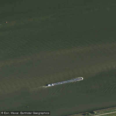
Hollandsch Diep
- Boat Ramps
- 0
- Access Points
- 0
- Campsites
- 0
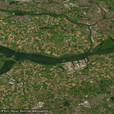
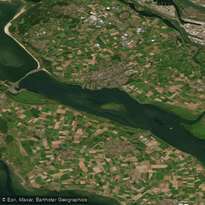
The Hollands Diep (historically spelled Hollandsch Diep) is a large, open estuary in the southwestern Netherlands, formed by the confluence of the Bergse Maas and the Nieuwe Merwede near Lage Zwaluwe. It functions as a major estuary of the Rhine and Meuse rivers, connecting through the Scheldt–Rhine Canal to the Scheldt river and Antwerp. Near Numansdorp, it splits into the Haringvliet and the Volkerak. The waterway is designated as a Ramsar Wetland site, recognized in 2000, reflecting its ecological significance.
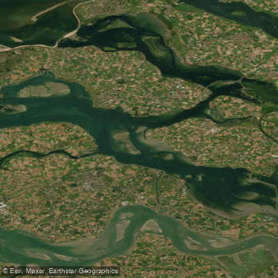
In terms of physical character, the Hollands Diep is a wide, open waterway featuring deep channels, hard structural edges, shell beds, and broad shallow plateaus. This varied bottom topography creates a dynamic aquatic environment. The water is relatively clear compared to some nearby systems. The scale and openness of the estuary mean paddlers should expect exposure to wind, tidal influence, and significant commercial and recreational vessel traffic. The Moerdijk bridges cross the eastern section, carrying road and rail traffic, while the Haringvliet bridge and Hellegatsdam cross near the western split point.
Paddlers should be aware that the Hollands Diep carries substantial boat traffic, including commercial shipping, and the open expanse makes it susceptible to wind-driven chop. The tidal range in the broader Zeeland delta region is approximately two meters, which will affect currents and water levels on the estuary. Recreational use of the water is well established — canoes, sloops, and stand-up paddleboards are all seen on the water during warmer months, and the area is popular for summer recreation. Willemstad is one of the access points for the waterway, with boat ramps and free parking available nearby.
The Hollands Diep was historically formed by the catastrophic St. Elizabeth's flood of 1421, which connected an earlier saltwater inlet to the Merwede, shaping the delta landscape that exists today. The surrounding delta region includes connections to the Biesbosch, Haringvliet, and Volkerak, offering paddlers the possibility of extended routes through the southwestern delta system. A fishing license (VISpas) is required for angling on the water, and paddlers should familiarize themselves with any local closed zones or regulations before launching.
Water access, boat ramps & amenities
Learn how to get on Hollandsch Diep. Uncover great paddling access points, boat ramps, and all the facilities you need for an unforgettable day on the water. Some locations shown may border or include private property. Always check property boundaries and applicable regulations before visiting. PaddleWays's Public & Private Land layer can help you plan your access with confidence.
Paddle smarter with real-time insights
Whether you're en route and conditions shift or you're looking for the best spot based on current flows, we enable you to make informed decisions on the fly.







North Brabant licenses and regulations
No licenses or regulations available for North Brabant.
Find Places to Paddle

Over 400,000 Places to Paddle
Every user gets free access to launch points, boat ramps, and public property parcels.


Water and weather conditions (10 day forecast)
See the best times to paddle Hollandsch Diep and check the forecast before you go.
Bovensluis
Paddling near Hollandsch Diep
Nieuwe Maas
Hollandsch Diep
Nieuwe Waterweg
Nieuwe Merwede
Haringvliet-west
Hollandsch Diep
Nieuwe Merwede
Oosterschelde
Beneden-Merwede
Explore North Brabant waters
Top paddling waters
No waters available right now.
Popular Cities
Loading popular cities...
Explore near Hollandsch Diep

Smarter Paddling Starts in the App.
Paddleways gives you everything you need to plan smarter, paddle better, and own every trip from first launch to takeout.