Sharatin Bay
- Saltwater
- Bay
Sharatin Bay
- Saltwater
- Bay
- Sq. miles
- 6.1
- Boat Ramps
- 0
- Access Points
- 0
- Campsites
- 0
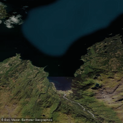
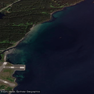
Sharatin Bay is a coastal bay on the Pacific Ocean, part of the larger Marmot Bay system near Ouzinkie on Kodiak Island, Alaska. The primary and most developed access point for paddlers is the Anton Larson public boat ramp, located approximately a ten-minute drive from Ouzinkie. This launch offers a concrete boat ramp and a parking lot, providing direct ocean access to the bay. The bay is a sheltered ocean environment with significant tidal influence. Paddlers must time their trips carefully around the tidal cycle, aiming for slack tide to achieve the easiest and safest conditions, as currents can be present. The water body is open to the Pacific, so paddlers should expect open water conditions and be prepared for wind exposure and potential swell. The area sees high recreational use, including sport fishing and kayaking, which suggests the possibility of motorized boat traffic. The recommended season for paddling is summer, specifically June through August. The surrounding terrain is diverse, with the shoreline composed of estuarine wetlands and tideflats. Three anadromous streams empty into the bay, and a notable saltwater lagoon is present along the northern shore, accessible via a foot trail from the shoreline. The area is part of Alaska's vast wilderness, offering solitude and coastal exploration opportunities suitable for beginners who have a basic awareness of tidal flow and ocean safety. More experienced paddlers can use the bay as a starting point for longer coastal sea kayaking journeys. Cell service in the area is limited.
Water access, boat ramps & amenities
Learn how to get on Sharatin Bay. Uncover great paddling access points, boat ramps, and all the facilities you need for an unforgettable day on the water. Some locations shown may border or include private property. Always check property boundaries and applicable regulations before visiting. PaddleWays's Public & Private Land layer can help you plan your access with confidence.
Paddle smarter with real-time insights
Whether you're en route and conditions shift or you're looking for the best spot based on current flows, we enable you to make informed decisions on the fly.








Find Places to Paddle

Over 400,000 Places to Paddle
Every user gets free access to launch points, boat ramps, and public property parcels.


Tides, wind & water conditions (10 day forecast)
On open water, wind and tide matter as much as the weather. See the best times to paddle Sharatin Bay and check the marine forecast before you launch.
Loading tide predictions…
Paddling near Sharatin Bay
Explore Alaska waters
Top paddling waters
Popular Cities
Loading popular cities...
Explore near Sharatin Bay

Smarter Paddling Starts in the App.
Paddleways gives you everything you need to plan smarter, paddle better, and own every trip from first launch to takeout.