Diamond Creek
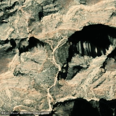
Diamond Creek
- Boat Ramps
- 1
- Access Points
- 1
- Campsites
- 13
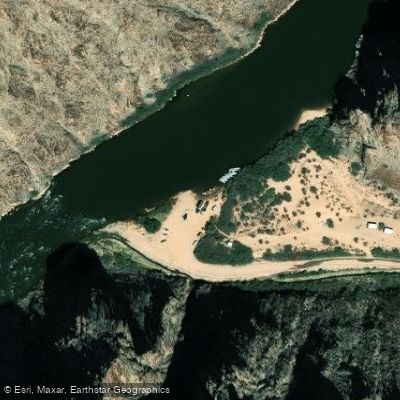
Diamond Creek flows through the western reaches of Grand Canyon, serving as a critical tributary to the Colorado River at approximately river mile 225.9. This desert waterway originates in the highlands near Peach Springs on the Hualapai Indian Reservation, descending through rugged canyon country before its confluence with the Colorado River deep within Grand Canyon's inner gorge. The creek's primary significance lies in its role as the only vehicle-accessible point to the Colorado River within Grand Canyon for hundreds of miles. Diamond Creek Road, a 21-mile unpaved route beginning at Peach Springs in Mohave County, follows the drainage down to the river. This road serves dual purposes as both access route and natural streambed, making conditions highly variable depending on weather, particularly after monsoon storms when flash flooding can render it impassable.
For paddlers, Diamond Creek represents a crucial takeout point for Colorado River expeditions. Commercial and private rafting trips frequently conclude here after journeys ranging from 9 to 17 days beginning at Lees Ferry. The Diamond Creek launch site also serves as the starting point for shorter 2-5 day noncommercial river trips continuing downstream approximately 55 miles to Pearce Ferry, traversing some of the deepest sections of Grand Canyon with canyon walls rising 3,500 to 4,000 feet overhead. This lower canyon section features significant whitewater including the legendary Lava Falls at mile 179.4, considered one of North America's most formidable rapids. The stretch encompasses approximately 23 rapids rated Class 5 or higher on the Grand Canyon scale, with flows regulated by Glen Canyon Dam maintaining relatively consistent water levels year-round at 48-55°F.
Access requires permits from both the National Park Service and the Hualapai Tribe, whose ancestral lands encompass this area. The Hualapai people consider the Colorado River—known as "Ha'yiđađa" or the backbone—sacred, believing they were created from its sediment and clay. Visitors must contact Hualapai Game and Fish in Peach Springs to arrange tribal permits and pay required fees before accessing Diamond Creek Road.
The area supports desert-adapted wildlife including bighorn sheep, chuckwallas, and various lizard species, with occasional sightings of deer, eagles, and bobcats. Riparian vegetation along the creek provides critical habitat in this arid landscape. Summer temperatures regularly exceed 110°F, making spring and fall optimal for river travel. The remote location, lack of cell service, and challenging road conditions demand proper preparation, high-clearance vehicles, and sufficient supplies for emergencies.
Water access, boat ramps & amenities
Learn how to get on Diamond Creek. Uncover great paddling access points, boat ramps, and all the facilities you need for an unforgettable day on the water. Some locations shown may border or include private property. Always check property boundaries and applicable regulations before visiting. PaddleWays's Public & Private Land layer can help you plan your access with confidence.
Paddle smarter with real-time insights
Whether you're en route and conditions shift or you're looking for the best spot based on current flows, we enable you to make informed decisions on the fly.








Find Places to Paddle

Over 400,000 Places to Paddle
Every user gets free access to launch points, boat ramps, and public property parcels.


Water and weather conditions (10 day forecast)
See the best times to paddle Diamond Creek and check the forecast before you go.
DIAMOND CREEK NEAR PEACH SPRINGS, AZ

Explore Arizona waters
Top paddling waters
Popular Cities
Loading popular cities...
Explore near Diamond Creek
Access points
Nearby waters
More in Arizona

Smarter Paddling Starts in the App.
Paddleways gives you everything you need to plan smarter, paddle better, and own every trip from first launch to takeout.