Lake Havasu
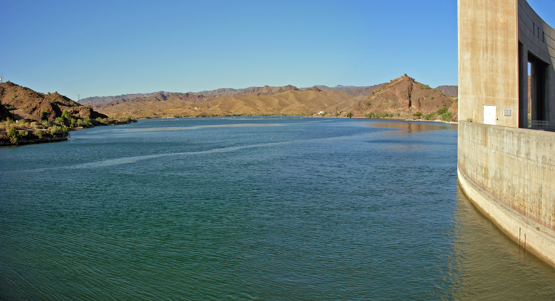
Lake Havasu
- Boat Ramps
- 15
- Access Points
- 16
- Campsites
- 72
Lake Havasu is a 619,400-acre reservoir straddling the Arizona-California border, offering 400 miles of shoreline and crystal-clear blue-green waters. Popular access points include Rotary Park, Site Six Launch Ramp, and Lake Havasu State Park. The lake experiences 300 days of sunshine annually, with spring (May-June) and fall (September-October) providing ideal paddling conditions. Summer temperatures can exceed 100°F, making early morning paddling preferable to avoid intense heat and afternoon winds.
Notable paddling destinations include the historical London Bridge, Red Rock's 100-foot red cliffs, Pirate's Cove with its anchored pirate ship, and Topock Gorge's volcanic canyon. Wildlife sightings may include bighorn sheep, bald eagles, and various waterfowl. The lake features 26 small lighthouses scattered along its shores.
Paddlers should be aware of heavy motorized boat traffic, especially during summer weekends and holidays. A counter-clockwise travel direction is recommended for all watercraft. Water quality is routinely tested and deemed safe for swimming. Lake levels remain relatively constant year-round.
Entrance fees range from $15-20 per vehicle, with additional costs for camping and boat permits. Facilities include beachfront campsites, cabins, restrooms, and picnic areas at various locations around the lake. Multiple rental companies in Lake Havasu City offer kayaks and paddleboards for visitors.
The lake's unique blue-green color comes from calcium carbonate-rich water flowing over travertine rock. Originally created by the Parker Dam in the 1930s, Lake Havasu now serves as a major recreational destination, blending natural beauty with historical landmarks like the relocated London Bridge.
Water access, boat ramps & amenities
Learn how to get on Lake Havasu. Uncover great paddling access points, boat ramps, and all the facilities you need for an unforgettable day on the water. Some locations shown may border or include private property. Always check property boundaries and applicable regulations before visiting. PaddleWays's Public & Private Land layer can help you plan your access with confidence.
Paddle smarter with real-time insights
Whether you're en route and conditions shift or you're looking for the best spot based on current flows, we enable you to make informed decisions on the fly.








Find Places to Paddle

Over 400,000 Places to Paddle
Every user gets free access to launch points, boat ramps, and public property parcels.


Water and weather conditions (10 day forecast)
See the best times to paddle Lake Havasu and check the forecast before you go.
COLORADO RIVER BELOW PARKER DAM, AZ-CA
All Flow Stations


Explore Arizona waters
Top paddling waters
Popular Cities
Loading popular cities...
Explore near Lake Havasu
Access points
- Parker Dam Boat Ramp
- Havasu Palms Boat Ramp
- Black Meadow Landing Boat Ramp
- Cattail Cove State Park Boat Ramp
- Havasu Landing Resort Boat Ramp
- Lake Havasu State Park - 3 Boat Ramp
- Take Off Point Day Use Area Boat Ramp
- Lake Havasu - 3 Boat Ramp
- Lake Havasu - 4 Boat Ramp
- Lake Havasu State Park - 1 Boat Ramp
- Lake Havasu - 5 Boat Ramp
- Lake Havasu - Site Six Boat Ramp
- All 143 spots
More in Arizona

Smarter Paddling Starts in the App.
Paddleways gives you everything you need to plan smarter, paddle better, and own every trip from first launch to takeout.