Taunton Bay
- Saltwater
- Bay
Taunton Bay
- Saltwater
- Bay
- Sq. miles
- 9.6
- Boat Ramps
- 0
- Access Points
- 0
- Campsites
- 0
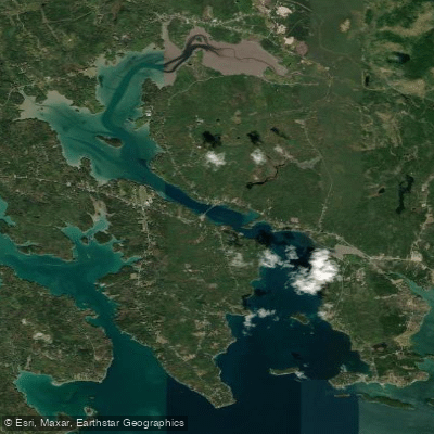
Taunton Bay is a substantial tidal estuary on the coast of Maine, characterized by a significant tidal range of 9 to 12 feet and strong currents that can reach 5 to 6 knots. This dynamic environment dictates that all paddling plans must be made with careful consideration of the tide stage. Paddlers should aim to travel with the current whenever possible, as paddling against these strong flows can be hazardous and exhausting. The bay is connected to Frenchman Bay via Sullivan Harbor, and a notable feature is the Reversing Falls located just south of the Route 1 bridge, which generates large, powerful waves as the tide changes. A key public access point for paddlers is Gordon's Wharf, a historic stone wharf on the Taunton River north of the falls, which provides the primary public launch above the tidal rapids. The bay's extensive mud flats are exposed at low tide, which can significantly alter the navigable area and shoreline access. Wind exposure can be considerable, and the bay's connection to larger Frenchman Bay means conditions can build, with seas reported in the 3 to 5-foot range during stronger winds. A recommended and ambitious route for experienced paddlers involves navigating from Sullivan Harbor into Taunton Bay, then winding through Carrying Place Creek to the Skillings River and back out to Frenchman Bay, a journey of nearly 20 nautical miles that requires precise tidal timing for a safe and manageable trip. For safety, paddling in pairs is strongly advised over going alone. The surrounding area offers a quiet, wooded coastline with views of local lobster fishing activity and opportunities to spot marine wildlife such as seals and loons.
Water access, boat ramps & amenities
Learn how to get on Taunton Bay. Uncover great paddling access points, boat ramps, and all the facilities you need for an unforgettable day on the water. Some locations shown may border or include private property. Always check property boundaries and applicable regulations before visiting. PaddleWays's Public & Private Land layer can help you plan your access with confidence.
Paddle smarter with real-time insights
Whether you're en route and conditions shift or you're looking for the best spot based on current flows, we enable you to make informed decisions on the fly.








Find Places to Paddle

Over 400,000 Places to Paddle
Every user gets free access to launch points, boat ramps, and public property parcels.


Tides, wind & water conditions (10 day forecast)
On open water, wind and tide matter as much as the weather. See the best times to paddle Taunton Bay and check the marine forecast before you launch.
Loading tide predictions…
Paddling near Taunton Bay
Explore Maine waters
Top paddling waters
Popular Cities
Loading popular cities...
Explore near Taunton Bay
Access points
Nearby waters
More in Maine

Smarter Paddling Starts in the App.
Paddleways gives you everything you need to plan smarter, paddle better, and own every trip from first launch to takeout.