
Curated by PaddleWays

Elk River

1 mi flatwater route on the Elk River in Oregon

  • Flatwater

Map of the Elk River route, from Elk River Fish Hatchery Access
  • Route
  • Put-in & take-out

Level right now

How Elk River is running today

Route facts

Elk River at a glance

Distance
1 mi
Paddle time
~0.5 hrs
Type
Flatwater

About this route

Paddling Elk River

This 1-mile flatwater river route runs on the Elk River in Curry County, Oregon, with both the put-in and take-out at the Elk River Fish Hatchery Access. The Elk River holds Wild and Scenic designation.

Bank access along the river is limited, and the hatchery is a primary access point for the water.

Put-in & take-out

Hazards

Hazards on Elk River

No hazards are marked on Elk River yet. That is not the same as none being there: if you find one, report it for the next paddler.

From the community

Elk River trip reports

Real trips from PaddleWays paddlers who ran this route: how the flows were, and what to watch for.

Loading trip reports

  • Greg H.

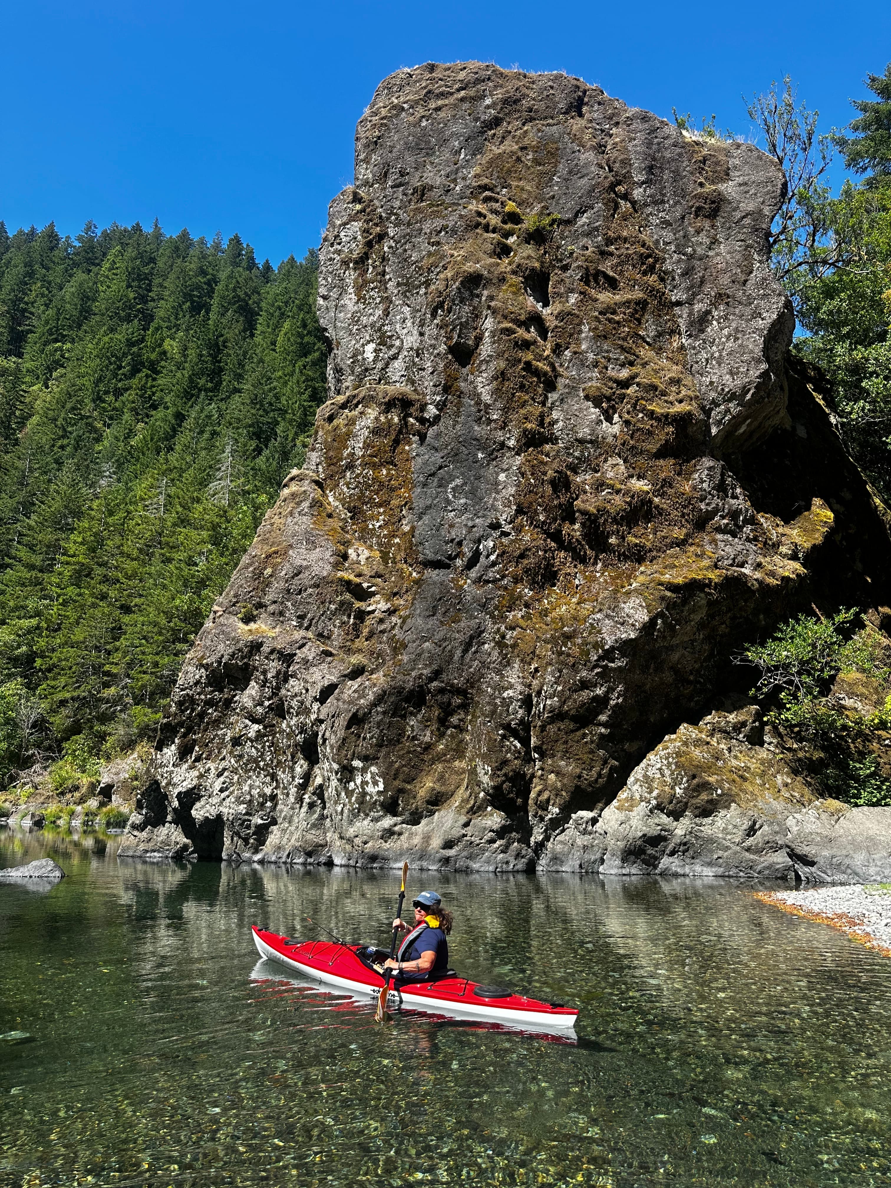
    Having battled harsh winds for the last two days, we decided to drive inland further and found a nice put-in at a State Fish Hatchery about six miles upriver. It was a beautiful day and the water was crystal clear. We arrived about 10:30 am and were the first on the water. It’s worth mentioning that there are put-ins at each end of the hatchery grounds. In the stretch in between, there is a rock drop-off that doesn’t have a good way to portage around. So either put in on the downriver end and head towards the ocean, or the upriver end and head inland. We went upriver and discovered that by mid-August stream levels were low enough that we had to get out several times to pull the kayak over gravel that grounded us. In between these gravel banks were beautiful pools and tall basalt cliffs. We didn’t go very far upstream, but enjoyed the day very much.
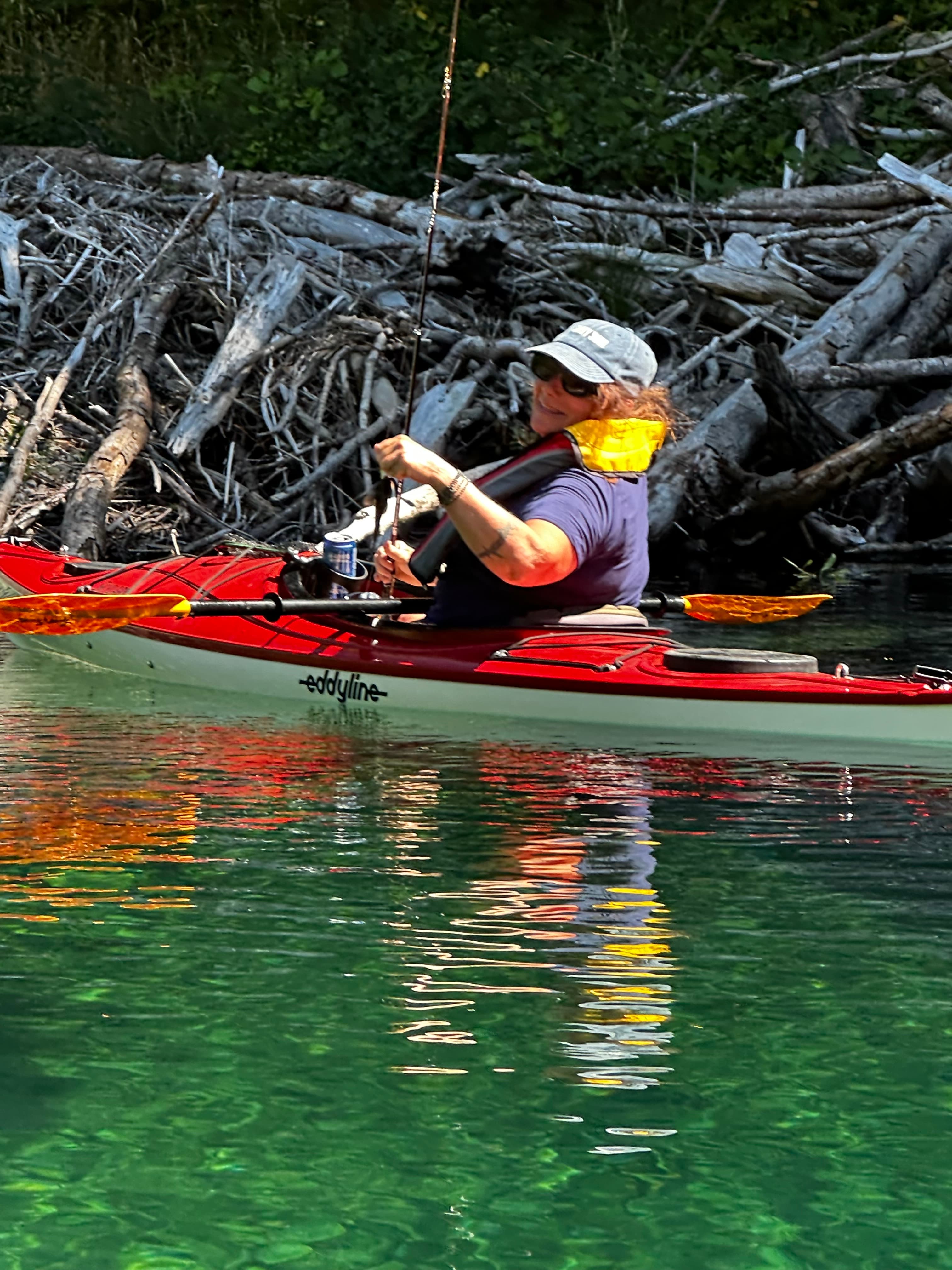
    • Photo 1 from Greg H.'s trip
    • Photo 2 from Greg H.'s trip
    Mentions: dam

Flows & weather (10 day forecast)

The gauges near Elk River and the forecast where it starts, so you can pick your day.

No forecast data available.

Same water

More routes on the Elk River

The other curated routes on the Elk River, each with how it is running now.

Curated by PaddleWays

RouteClass IV

Distance
5.2 mi
Paddle time
Multi-day
Best for
Intermediate paddlers, experienced paddlers
Put-in → take-out
Butler Bar Campground Access → Put In
Landslide Rapid becomes Class IV+ at high flow
Curated by PaddleWays

RouteClass IV

Distance
6.6 mi
Paddle time
Multi-day
Best for
Intermediate paddlers, experienced paddlers
Put-in → take-out
Put In → Take Out
Strong hydraulics and boils in gorge

Close by

Routes near Elk River

Curated routes on other waters within an hour or so, nearest first.

Curated by PaddleWays

RouteClass II–III

Distance
18 mi
Paddle time
~4.5 hrs
Put-in → take-out
Sixes River Campground Access → Cape Blanco State Park Boat Ramp
Curated by PaddleWays

RouteClass II–III

Distance
5.1 mi
Paddle time
~1.5 hrs
Best for
Kayak
Put-in → take-out
Edson Creek Boat Ramp → Sixes River Store Boat Ramp
Water levels fluctuate, flooding low-lying areas
Curated by PaddleWays

RouteClass IV

Distance
8.4 mi
Paddle time
~2 hrs
Best for
Experienced paddlers
Put-in → take-out
Put In → Take Out
Wood hazards and difficult exits
Curated by PaddleWays

RouteClass IV

Distance
6.1 mi
Paddle time
~1.5 hrs
Best for
Kayak, raft
Put-in → take-out
Take Out → Lobster Boat Ramp
Mobile wood at high flows
Curated by PaddleWays

RouteClass I–II

Distance
33.7 mi
Paddle time
Multi-day
Best for
Beginners, families
Put-in → take-out
Foster Bar Boat Ramp → Jot's Resort Boat Ramp
Curated by PaddleWays

RouteClass I–VI

Distance
3.9 mi
Paddle time
Multi-day
Best for
Intermediate paddlers, experienced paddlers
Put-in → take-out
Hoffman Bridge Boat Ramp → Bryant Park Boat Ramp
Strong afternoon breezes common

Smarter Paddling Starts in the App.

PaddleWays gives you everything you need to plan smarter, paddle better, and own every trip from first launch to takeout.