Paddling in Bighorn Canyon National Recreation Area
- National Recreation Area
- Open 24 hours
- Lakes
- 2
- Rivers
- 32
- Access
- 5
- Boat Ramps
- 8
- Shops
- 0
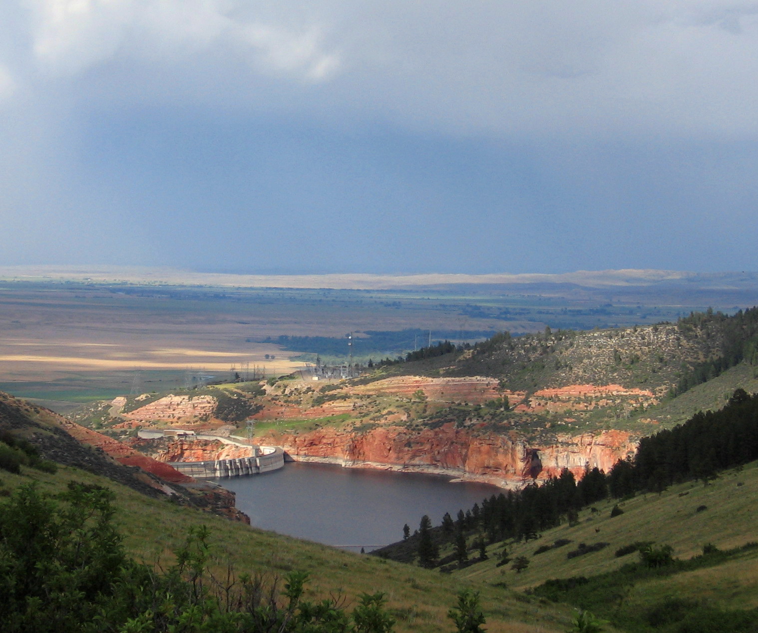
Bighorn Canyon National Recreation Area is reservoir paddling at a grand scale — a long, still lake running through one of the deeper canyons in the American West, straddling the Montana-Wyoming border. The water here is not river water anymore.
Yellowtail Dam, a 525-foot structure in the North District near Fort Smith, Montana, impounded the Bighorn River and created Bighorn Lake, a 71-mile corridor of flatwater that locals simply call Yellowtail.
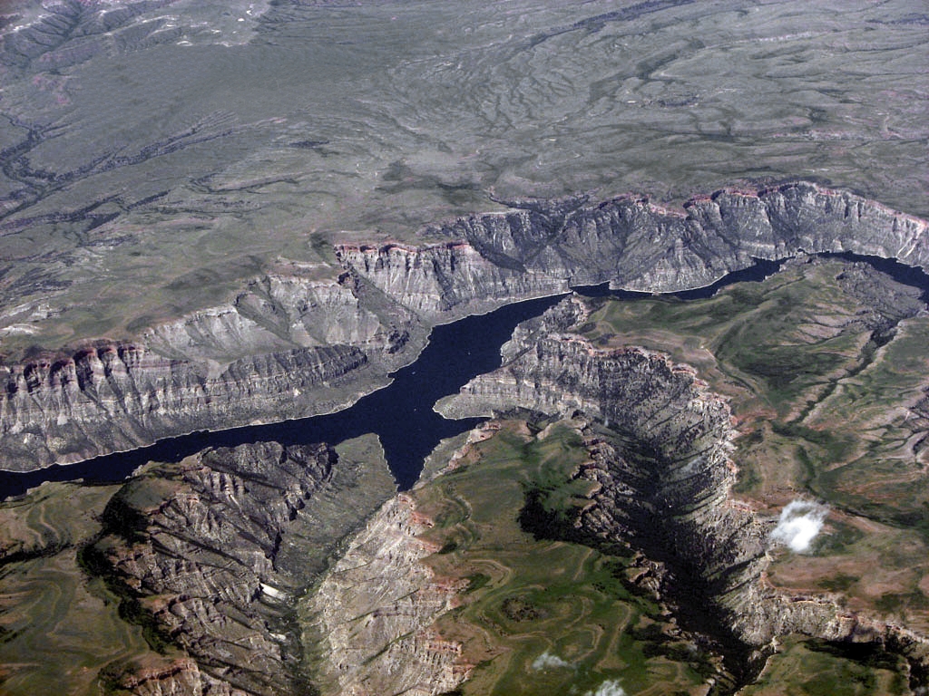
Fifty-five miles of that lake lie within the recreation area, winding between sandstone cliffs that rise close to a thousand feet off the water. Bighorn Lake is the paddling here.
Kayaks and canoes move through a canyon that has no road running its length — the two districts, North and South, sit three hours apart by car with no connecting route inside the park.
That geography means the canyon interior is accessible only by water, and the lake rewards paddlers willing to commit to it.
Boat-in campsites managed by the NPS make multi-day trips possible; day-use paddlers will find boat-in bathrooms and picnic areas along the route. Cell service is limited to none once you're in the canyon.
The North District launches from the Ok-A-Beh Marina near Fort Smith. The South District's primary put-in is Barry's Landing, reached from Lovell, Wyoming. The Crooked Creek Ranger Station near Horseshoe Bend on Highway 37 is another access point in the south.
Canoe and kayak rentals are available through concessionaires if you're not bringing your own boat.
Conditions on the lake are flatwater, but canyon winds and motorboat traffic — water skiing is common — mean paddlers in small craft should read the surface before committing to exposed stretches.
NPS law enforcement rangers patrol the lake and enforce right-of-way rules that favor the least maneuverable vessel.
A permit was required for kayak launch at Crooked Creek Ranger Station at the time of at least one recent visitor account; check with the park before you go, as requirements can change.
The canyon the Bighorn River carved before the dam went in was notorious for whirlpools and spring torrents. None of that remains.
What's left is silence, reflected walls, and the kind of distance that asks something of you — not technical skill, but time on the water.
Top waters to paddle near Bighorn Canyon National Recreation Area
Water and weather conditions (10 day forecast)
See the best times to paddle Bighorn Canyon National Recreation Area and check the forecast before you go.
No forecast data available.
Park alerts & road status
Closures and conditions Bighorn Canyon National Recreation Area has posted, from the National Park Service.
Checking the park's alerts…
Hours & fees
When Bighorn Canyon National Recreation Area is open and what it costs to get in, from the National Park Service.
Hours
Open 24 hoursBighorn Canyon NRA is open 24 hours a day, 365 days a year.
Entrance fees
No entrance fee is listed for this park.
Paddle smarter with real-time insights
Whether you're en route and conditions shift or you're looking for the best spot based on current flows, we enable you to make informed decisions on the fly.







Paddling near Bighorn Canyon National Recreation Area
Loading...
Other parks in Montana
Gateway towns
Where to base yourself for paddling in Bighorn Canyon National Recreation Area.
- LovellWY
Main gateway with the year-round Cal S. Taggart Visitor Center, hotels, and access to the South District's trails, marina, and wild horse range.
Base for the North District, home to Yellowtail Dam Visitor Center, park headquarters, and Ok-A-Beh Marina for boating and fishing.
Bighorn Canyon National Recreation Area paddling rules
The park's own rules, on top of Montana licenses and regulations. Limits, fees and closures change, so check the park's page before you go.

Invasive Species Boat Inspection
All boats, motorized and non-motorized, must be inspected for aquatic invasive species before launching. Inspection points are available in both the Lovell, WY and Fort Smith, MT districts. Check state rules and listed infected waters before you travel.

PWC Restricted Zones
Personal watercraft are allowed on Bighorn Lake but are banned in several specific areas, including south of The South Narrows, Crooked Creek Bay, and near Yellowtail Dam. Stay north of the park-installed buoy boundary and watch for posted restrictions at docks.

Sign the Boating Register
Boating registers are located at Ok-A-Beh, Barry's Landing, and Horseshoe Bend. Sign in before you head out and sign back in when you return. It is a simple step that helps keep you safe on the water.

Federal and State Rules Apply
Rangers enforce 36 C.F.R. Part 3, U.S. Coast Guard regulations, and the state law of whichever state you are boating in. Know the rules for both Montana and Wyoming before you launch.
Explore Bighorn Canyon National Recreation Area
Top paddling waters
Popular Cities
Loading popular cities...

Smarter Paddling Starts in the App.
Paddleways gives you everything you need to plan smarter, paddle better, and own every trip from first launch to takeout.