Muddy Creek
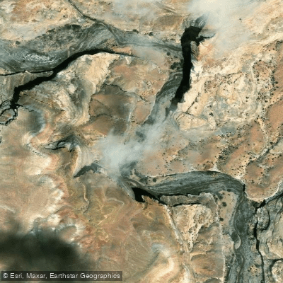
Muddy Creek
- Boat Ramps
- 2
- Access Points
- 2
- Campsites
- 0
Muddy Creek originates near the town of Emery in Emery County, Utah, flowing from the Wasatch Plateau through the dramatic geology of the San Rafael Swell before eventually joining the Dirty Devil River in Wayne County. The creek carves through approximately 100 miles of varied terrain, creating one of Utah's most distinctive waterways as it transitions from high country streams to desert canyon systems.
The creek's most celebrated feature is "The Chute," a 15-mile section running from Tomsich Butte to Hidden Splendor Mine (Chimney Canyon trailhead). This segment features a spectacular narrow box canyon where walls rise 200-300 feet above the creek, with passages narrowing to as little as 7-8 feet wide. The Chute represents the primary paddling opportunity on Muddy Creek, though its navigability depends entirely on seasonal flows.
Paddling The Chute is classified as Class II to Class II+ whitewater, featuring technical rock gardens and continuous riffles that demand solid boat control and river-reading skills. The run is suitable for inflatable kayaks (duckies), hardshell kayaks, and skilled canoeists, but explicitly not recommended for stand-up paddleboards or rafts due to technical rock sections and potential strainers. The entire section typically requires 5-10 hours to complete, depending on water levels and paddling efficiency.
Water availability represents the critical limiting factor for paddling Muddy Creek. The creek flows only during spring runoff, typically late May through early June, and only in years with above-average precipitation. Optimal flows range from 150-500 cubic feet per second (CFS) as measured at the USGS gauge near Emery, though flows between 200-400 CFS provide the best paddling experience. Below 150 CFS, extensive boat dragging becomes necessary; above 500 CFS, hazards increase significantly. Many years pass without sufficient water for floating.
When water levels are too low for paddling, The Chute serves as an exceptional hiking destination, requiring wading through shallow pools and walking the creek bed. Hikers should plan for ankle-to-thigh-deep water crossings and bring appropriate footwear.
The surrounding landscape showcases classic San Rafael Swell geology, with Entrada and Navajo sandstone formations creating the towering canyon walls. Wildlife includes wild horses, bighorn sheep, various raptor species, and the federally endangered Wright fishhook cactus, which inhabits the Factory Butte area near the creek's upper reaches.
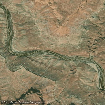
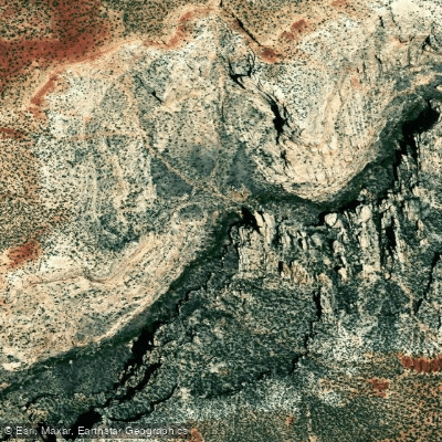
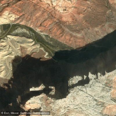
Access points include Tomsich Butte (put-in) and Hidden Splendor Mine at Chimney Canyon (take-out), both reached via rough dirt roads requiring high-clearance vehicles. The nearest significant town is Hanksville in Wayne County, approximately 20-30 miles from access points depending on the route. Green River provides additional services further north.
Flash flood danger is extreme throughout the Muddy Creek drainage. The narrow canyon sections offer no escape routes, making any trip during threatening weather conditions potentially fatal. Paddlers and hikers must never enter if rain is forecast anywhere in the watershed.
Water access, boat ramps & amenities
Learn how to get on Muddy Creek. Uncover great paddling access points, boat ramps, and all the facilities you need for an unforgettable day on the water. Some locations shown may border or include private property. Always check property boundaries and applicable regulations before visiting. PaddleWays's Public & Private Land layer can help you plan your access with confidence.
Paddle smarter with real-time insights
Whether you're en route and conditions shift or you're looking for the best spot based on current flows, we enable you to make informed decisions on the fly.








Find Places to Paddle

Over 400,000 Places to Paddle
Every user gets free access to launch points, boat ramps, and public property parcels.


Water and weather conditions (10 day forecast)
See the best times to paddle Muddy Creek and check the forecast before you go.
MUDDY CREEK NEAR EMERY, UT
All Flow Stations

Explore Utah waters
Top paddling waters
Popular Cities
Loading popular cities...
Explore near Muddy Creek

Smarter Paddling Starts in the App.
Paddleways gives you everything you need to plan smarter, paddle better, and own every trip from first launch to takeout.