Eld Inlet
- Saltwater
- Inlet
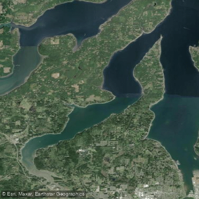
Eld Inlet
- Saltwater
- Inlet
- Sq. miles
- 5.8
- Boat Ramps
- 0
- Access Points
- 0
- Campsites
- 2
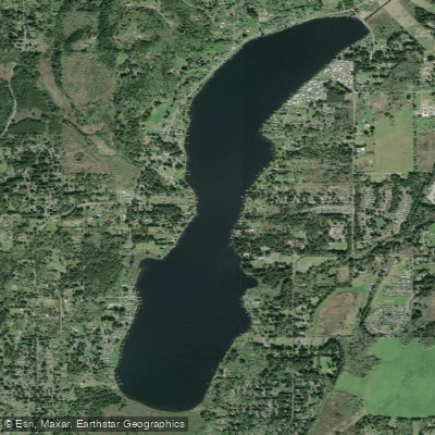
Eld Inlet is a roughly six-mile-long saltwater inlet on the southern edge of Puget Sound near Olympia, Washington. Its southernmost tip is known as Mud Bay. The shoreline is largely developed with houses, particularly on the west side, offering limited opportunities for landing ashore. Paddlers should be aware of significant tidal influence, with a typical range from lows around 8 feet to highs over 13 feet. The southern end of the inlet features extensive mudflats that become exposed at low tide, making timing crucial for exploration. Planning a paddle to coincide with a high tide, preferably a flood before slack, is recommended to access the upper reaches, including areas past the Highway 101 bridge and into McLane Creek. Currents are present, and paddlers should be prepared for potential wind and waves, especially in winter, with conditions capable of producing waves up to 2.5 feet and winds to 15 knots.
Several public launch points exist but have specific considerations. Frye Cove County Park offers a launch with heated restrooms, but access involves a steep incline and the gate opening time can be inconsistent, between 8:00 and 9:00 AM. The Boston Harbor boat launch at 312 73rd Ave NE is another option, requiring a Discover Pass for parking; kayakers should use the roadside kayak parking, not the trailer lot. Young Cove boat launch at 2414 Gravelly Beach Loop Road NW charges a $5 fee per boat to launch and has limited parking, though portable restrooms are available. Another unnamed launch site also charges $5 to put in and $5 to take out. Facilities like Buzz's Bar Grill and the Shipwreck Cafe are potential stops.
The inlet features tidal estuaries and productive shellfish beds. Notable sights include a totem pole marking a former Indigenous village site approximately two nautical miles north of the Highway 101 bridge, though signage requests visitors not to enter. The area is managed in part by the Capitol Land Trust, which has several conservation preserves along the shores, including at Triple Creek Farm, McLane Point, Randall Preserve, and Lower Eld Estuary Preserve. The Trust prefers that kayakers do not land at these preserves to minimize wildlife disturbance. Wildlife includes nesting bald eagles. Poison oak is present in the area. A full-length paddle from a northern launch like Boston Harbor to the southern end of the inlet and back can be a long trip, approximately 19 nautical miles, requiring careful consideration of fitness and conditions.
Water access, boat ramps & amenities
Learn how to get on Eld Inlet. Uncover great paddling access points, boat ramps, and all the facilities you need for an unforgettable day on the water. Some locations shown may border or include private property. Always check property boundaries and applicable regulations before visiting. PaddleWays's Public & Private Land layer can help you plan your access with confidence.
Paddle smarter with real-time insights
Whether you're en route and conditions shift or you're looking for the best spot based on current flows, we enable you to make informed decisions on the fly.








Find Places to Paddle

Over 400,000 Places to Paddle
Every user gets free access to launch points, boat ramps, and public property parcels.


Tides, wind & water conditions (10 day forecast)
On open water, wind and tide matter as much as the weather. See the best times to paddle Eld Inlet and check the marine forecast before you launch.
Loading tide predictions…
Paddling near Eld Inlet

Explore Washington waters
Top paddling waters
Popular Cities
Loading popular cities...
Explore near Eld Inlet

Smarter Paddling Starts in the App.
Paddleways gives you everything you need to plan smarter, paddle better, and own every trip from first launch to takeout.