Embalse Aqua del Toro
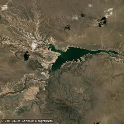
Embalse Aqua del Toro
- Boat Ramps
- 0
- Access Points
- 0
- Campsites
- 0
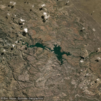
Embalse Agua del Toro is a reservoir formed by an arch dam on the Río Diamante, located approximately 84–89 kilometers west of San Rafael in Mendoza Province, Argentina. The dam itself stands 118.5 meters high and was completed in 1973, with the associated hydroelectric station commissioned in 1982. At maximum normal operating level, the reservoir covers approximately 1,085 hectares with a volume of around 296 cubic hectometers, making it the second largest reservoir in Mendoza Province.
The reservoir sits within an area known as Pampa Amarilla, backed by Andean scenery including views toward the Diamante volcano. The water surface is notably green in appearance. Water levels have varied considerably over the decades, with significant fluctuations tied to snowmelt cycles, drought periods, and upstream regulation — a factor paddlers should keep in mind when planning a visit, as the usable water surface can change substantially from year to year.
A range of water sports are practiced on the reservoir, including sailing, rowing, motorboating, diving, and windsurfing. The reservoir is also well regarded as a fishing destination, particularly for pejerrey and salmonids.
Access to the reservoir is via gravel roads. The two primary routes are from Pareditas along the old Ruta 40 alignment, and from Las Salinas connecting to Ruta 144. Both roads have been improved in recent years and can accommodate small vehicles and those towing boats, though conditions can deteriorate in wet weather and caution is advised. The reservoir can also be reached via gravel roads from National Route 40 or through the Los Reyunos circuit. A higher-clearance vehicle is generally recommended. The area is best visited during daylight hours.
The reservoir is part of the Río Diamante hydroelectric system, jointly operated for power generation, flood control, and irrigation of approximately 90,000 hectares downstream. These operational priorities mean water levels are actively managed and can shift independently of natural precipitation patterns, which is a relevant consideration for paddlers planning around shoreline access or launch points.
Water access, boat ramps & amenities
Learn how to get on Embalse Aqua del Toro. Uncover great paddling access points, boat ramps, and all the facilities you need for an unforgettable day on the water. Some locations shown may border or include private property. Always check property boundaries and applicable regulations before visiting. PaddleWays's Public & Private Land layer can help you plan your access with confidence.
Paddle smarter with real-time insights
Whether you're en route and conditions shift or you're looking for the best spot based on current flows, we enable you to make informed decisions on the fly.







Mendoza licenses and regulations

Find Places to Paddle

Over 400,000 Places to Paddle
Every user gets free access to launch points, boat ramps, and public property parcels.


Water and weather conditions (10 day forecast)
See the best times to paddle Embalse Aqua del Toro and check the forecast before you go.
No forecast data available.
Paddling near Embalse Aqua del Toro
Explore Mendoza waters
Top paddling waters
No waters available right now.
Popular Cities
Loading popular cities...
Explore near Embalse Aqua del Toro

Smarter Paddling Starts in the App.
Paddleways gives you everything you need to plan smarter, paddle better, and own every trip from first launch to takeout.