Bald Hills Creek
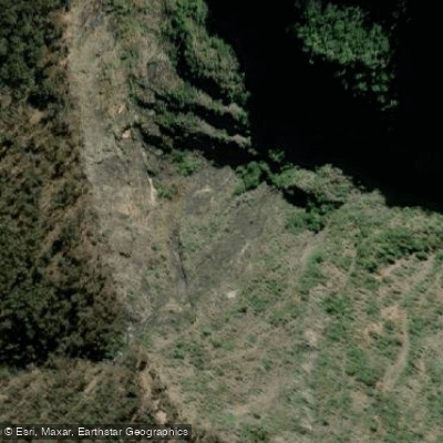
Bald Hills Creek
- Boat Ramps
- 0
- Access Points
- 0
- Campsites
- 0
Bald Hills Creek is a tidal waterway in Brisbane's northern suburbs, flowing through the Tinchi Tamba Wetlands near Bald Hills. The creek branches off the North Pine River approximately 1.3 kilometres from the river's mouth at Bramble Bay, and extends roughly 4 kilometres before becoming choked with vegetation. The creek runs largely parallel to the Houghton Highway for a section, which introduces some road noise, but the majority of the paddle is through mangrove-lined banks that provide considerable wind protection.
The standard out-and-back route covers 11.1 kilometres and typically takes around four hours to complete. The paddle is rated moderate in difficulty. The creek is generally wide and straightforward, passing derelict jetties, a mangrove island, and a bird hide associated with the Tinchi Tamba Wetlands walking tracks. Several short tributaries branch off the main channel and are worth exploring, including one that forms part of the Eagle Canoe Trail. A useful turnaround marker is an old dome-shaped brick sewer drain near the upper end of the navigable section.
The primary launch point is Brighton Park on the Hornibrook Highway in Brighton, located approximately 30 minutes north of Brisbane's CBD. The park is accessed by turning left off the Houghton Highway just before the bridge when heading north toward Redcliffe. Parking at the launch site is ample relative to typical visitor numbers. Alternative launch options include the Tinchi Tamba boat ramp accessed from Wyampa Road in Bald Hills, as well as boat ramps at Lawnton, Barungwarra, and Strathpine, though these require careful attention to tides as the waterway is tidal and can be shallow in places.
Tidal conditions are an important planning consideration throughout the route. Timing the tide correctly allows paddlers to ride the incoming tide up Bald Hills Creek and return with the outgoing tide on the North Pine River. The paddle can be undertaken year-round, though limited shade along portions of the route makes early morning or afternoon starts preferable to midday paddling. The Tinchi Tamba Wetlands area is noted as habitat for a wide variety of birdlife, and Eastern Grey Kangaroos are commonly seen in the grassed areas adjacent to the wetlands.
Water access, boat ramps & amenities
Learn how to get on Bald Hills Creek. Uncover great paddling access points, boat ramps, and all the facilities you need for an unforgettable day on the water. Some locations shown may border or include private property. Always check property boundaries and applicable regulations before visiting. PaddleWays's Public & Private Land layer can help you plan your access with confidence.
Paddle smarter with real-time insights
Whether you're en route and conditions shift or you're looking for the best spot based on current flows, we enable you to make informed decisions on the fly.








Find Places to Paddle

Over 400,000 Places to Paddle
Every user gets free access to launch points, boat ramps, and public property parcels.


Water and weather conditions (10 day forecast)
See the best times to paddle Bald Hills Creek and check the forecast before you go.
No forecast data available.
Paddling near Bald Hills Creek
Bellinger River
Bobo River
Coffs Harbour Creek
Kalang River
Little Nymboida River
Bonville
Bonville Creek
Pine Creek
Park Beach
Coffs Creek
Explore New South Wales waters
Top paddling waters
No waters available right now.
Popular Cities
Loading popular cities...
Explore near Bald Hills Creek

Smarter Paddling Starts in the App.
Paddleways gives you everything you need to plan smarter, paddle better, and own every trip from first launch to takeout.