Boyd River
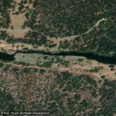
Boyd River
- Boat Ramps
- 0
- Access Points
- 0
- Campsites
- 1
The Boyd River is formed by the confluence of the Sara and Guy Fawkes Rivers, flowing through Guy Fawkes River National Park and Chaelundi National Park in northern New South Wales. It sits below the Dorrigo Plateau within the Great Dividing Range, east-southeast of Glen Innes, and joins the Nymboida River at the township of Buccarumbi (NSW 2460) in the Clarence Valley region. The river is part of a broader network — including the Orara, Nymboida, Guy Fawkes, Henry, and Mann rivers — that feeds into the Clarence River, widely regarded as one of Australia's premier whitewater environments.
The Boyd River is described as suitable for paddling year-round. The water flows swiftly over shallow rocky bottoms and through intermittent deep pools, and despite originating from mountain country, water temperatures are noted as comfortable for swimming throughout the year. The river offers a mix of whitewater rapids and calmer stretches, making it accessible to both experienced paddlers and beginners. It is used in conjunction with the Nymboida River for guided canoeing and rafting tours, including half-day whitewater canoeing experiences that run approximately four hours. The Boyd River also forms part of the Clarence Canoe and Kayak Trail, described as the longest mapped whitewater trail in Australia.
The surrounding landscape supports diverse wildlife. Paddlers can expect to encounter rock wallabies, water dragons, wombats, lyrebirds, echidnas, kangaroos, and platypus, as well as golden, blue, and red dragonflies. The river corridor passes through national park land, offering rainforest and gorge scenery along its course.
Access to the area is via the historic Old Glenn Innes Highway, which runs alongside the river. The Dalmorton area (NSW 2460) serves as a reference point for the river. Guided tours operating on the Boyd River are run by Exodus Adventures, based at Buccarumbi, and include equipment, guides with over 30 years of experience, a 4WD support vehicle, and snacks and drinks. The river is also suitable for packrafting combined with mountain biking, with the bike-in/raft-out format documented by local paddlers. Picnic areas are available in the vicinity, though the site is noted as not catering for people with access needs.
Water access, boat ramps & amenities
Learn how to get on Boyd River. Uncover great paddling access points, boat ramps, and all the facilities you need for an unforgettable day on the water. Some locations shown may border or include private property. Always check property boundaries and applicable regulations before visiting. PaddleWays's Public & Private Land layer can help you plan your access with confidence.
Paddle smarter with real-time insights
Whether you're en route and conditions shift or you're looking for the best spot based on current flows, we enable you to make informed decisions on the fly.








Find Places to Paddle

Over 400,000 Places to Paddle
Every user gets free access to launch points, boat ramps, and public property parcels.


Water and weather conditions (10 day forecast)
See the best times to paddle Boyd River and check the forecast before you go.
Boyd River At Broadmeadows
All Flow Stations
Paddling near Boyd River
Bellinger River
Bobo River
Coffs Harbour Creek
Kalang River
Little Nymboida River
Bonville
Bonville Creek
Pine Creek
Park Beach
Coffs Creek
Explore New South Wales waters
Top paddling waters
No waters available right now.
Popular Cities
Loading popular cities...
Explore near Boyd River
Access points
Nearby waters
More in New South Wales

Smarter Paddling Starts in the App.
Paddleways gives you everything you need to plan smarter, paddle better, and own every trip from first launch to takeout.