Roper River
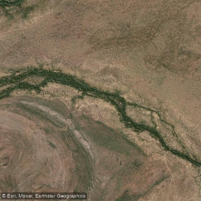
Roper River
- Boat Ramps
- 1
- Access Points
- 0
- Campsites
- 3
The Roper River flows east for approximately 400 kilometres from the Katherine region of the Northern Territory to the Gulf of Carpentaria, making it one of the longer free-flowing river systems in northern Australia. It sits within the wet-dry tropics, a climate regime that has significant implications for when and how the river can be paddled.
Established boat ramps and river access points exist at Roper Bar, Tomato Island, and Port Roper, with an additional facility at Four Mile Landing. These points serve both recreational boaters and commercial operators, and the stretch from Roper Bar downstream to the river mouth is approximately 105 kilometres. Recreational fishing and camping are popular activities throughout the area, meaning paddlers can expect to share the water with motorised fishing boats, particularly around the main access points.
The river corridor passes through or adjacent to Limmen National Park, and much of the surrounding land is a mix of pastoral leasehold and Indigenous-held title. First Nations communities have continuous cultural and custodial connections to the river and its surrounds, and paddlers should be aware that land access and river access in some areas may be subject to agreements or restrictions tied to Aboriginal freehold land and native title. Checking current access conditions before launching is advisable.
The river is fed in part by an aquifer system, and ongoing debates over water extraction from that aquifer reflect the ecological sensitivity of the system. The upper reaches have been described as having notably green water. The broader catchment supports a range of land uses including pastoralism, mining, and irrigated agriculture.
Given the wet-dry tropical climate, the dry season — roughly May through October — is generally the period when travel and access in remote northern Australia is most practical, as wet season rains can render roads and access tracks impassable. Paddlers planning a trip should factor in the remoteness of the river corridor and the limited infrastructure along its length.
Water access, boat ramps & amenities
Learn how to get on Roper River. Uncover great paddling access points, boat ramps, and all the facilities you need for an unforgettable day on the water. Some locations shown may border or include private property. Always check property boundaries and applicable regulations before visiting. PaddleWays's Public & Private Land layer can help you plan your access with confidence.
Paddle smarter with real-time insights
Whether you're en route and conditions shift or you're looking for the best spot based on current flows, we enable you to make informed decisions on the fly.







Northern Territory licenses and regulations

Find Places to Paddle

Over 400,000 Places to Paddle
Every user gets free access to launch points, boat ramps, and public property parcels.


Water and weather conditions (10 day forecast)
See the best times to paddle Roper River and check the forecast before you go.
Roper River - Elsey Homestead
All Flow Stations
Paddling near Roper River
Katherine River
Leight Creek
Daly River
King River
Flora River
Ironbark Creek
Mullens Creek
Explore Northern Territory waters
Top paddling waters
No waters available right now.
Popular Cities
Loading popular cities...
Explore near Roper River
Access points
More in Northern Territory

Smarter Paddling Starts in the App.
Paddleways gives you everything you need to plan smarter, paddle better, and own every trip from first launch to takeout.