Althaus Creek
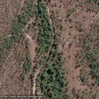
Althaus Creek
- Boat Ramps
- 3
- Access Points
- 1
- Campsites
- 1
Althaus Creek is a tidal estuary located north of Townsville in Queensland, flowing between the communities of Saunders Beach and Bluewater. The creek sits within the Townsville City Council area and is subject to tidal influence, meaning water levels and access conditions vary with the tides.
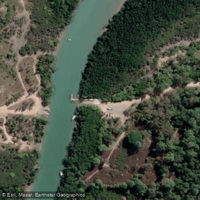
There are two boat ramps providing access to the creek, positioned on opposite banks. The Saunders Beach boat ramp is located on the south bank at the end of Saunders Beach Boat Ramp Road, off Saunders Beach Road past Atoll Street, at GPS coordinates 19.15696° S, 146.59904° E. This ramp is tide-limited, has a single lane with a 10-degree slope, a pontoon, and parking for 15 cars with trailers. The Bluewater boat ramp sits on the north bank at 78 Jaloonda Road, Bluewater, at GPS coordinates 19.15709° S, 146.59856° E, with a single lane, a 7-degree slope, and parking for 15 cars with trailers. Both ramps are managed by Townsville City Council and rated to handle loads of up to 5 tonnes.
The most significant safety consideration for paddlers on Althaus Creek is the presence of estuarine (saltwater) crocodiles. Under the Queensland Crocodile Management Plan, Althaus Creek falls within Zone E, the General Management zone, meaning crocodiles displaying dangerous behaviour in the area are targeted for removal. In September 2022, a 3.2-metre male estuarine crocodile was captured and removed from the Althaus Creek landing area near Saunders Beach after it was observed approaching fishers and boats. The creek is also described as a busy fishing spot with a nearby camping area, which means paddlers should expect other water users, particularly around the boat ramp areas. Crocodile sightings should be reported to the Queensland Department of Environment and Science via the QWildlife app or by calling 1300 130 372. Paddlers are advised to follow CrocWise safety guidelines at all times when on or near the water.
Water access, boat ramps & amenities
Learn how to get on Althaus Creek. Uncover great paddling access points, boat ramps, and all the facilities you need for an unforgettable day on the water. Some locations shown may border or include private property. Always check property boundaries and applicable regulations before visiting. PaddleWays's Public & Private Land layer can help you plan your access with confidence.
Paddle smarter with real-time insights
Whether you're en route and conditions shift or you're looking for the best spot based on current flows, we enable you to make informed decisions on the fly.







Queensland licenses and regulations

Find Places to Paddle

Over 400,000 Places to Paddle
Every user gets free access to launch points, boat ramps, and public property parcels.


Water and weather conditions (10 day forecast)
See the best times to paddle Althaus Creek and check the forecast before you go.
No forecast data available.
Paddling near Althaus Creek
Ross River
Gordon Creek
Bohle River
Ross Creek
Crocodile Creek
Barramundi Creek
Keelbottom Creek
Alligator Creek
Burdekin River
Explore Queensland waters
Top paddling waters
No waters available right now.
Popular Cities
Loading popular cities...
Explore near Althaus Creek
Access points
Nearby waters
More in Queensland

Smarter Paddling Starts in the App.
Paddleways gives you everything you need to plan smarter, paddle better, and own every trip from first launch to takeout.