Owl River
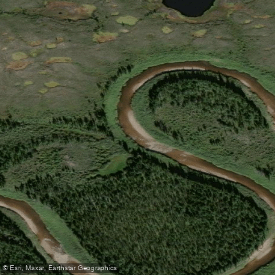
Owl River
- Boat Ramps
- 0
- Access Points
- 0
- Campsites
- 0
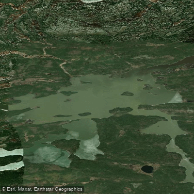
The Owl River flows northeast through the centre of Wapusk National Park in Manitoba's far northeast, emptying into Hudson Bay. The paddling route runs approximately 100 kilometres as the crow flies from the put-in at Herchmer to the bay, though the actual distance paddled is considerably longer due to the river's twists and turns. The river is approximately 241 kilometres in total length according to mapping data. The typical trip takes about two weeks to complete.
Access to the put-in is at the Herchmer railway siding, served by Via Rail's Winnipeg-Churchill route. Paddlers disembark directly at the river crossing. Herchmer is located just over 100 kilometres north of Gillam. Because there is no road access to the takeout, an arranged helicopter flight from the river's mouth to Churchill or Gillam is required and represents the most significant expense of the trip, potentially running into the thousands of dollars, though costs can be reduced when split among a group.
The upper portion of the river moves quickly through a mix of northern boreal forest and regenerating burn areas. As the river winds toward the coast, the forest thins to a narrow band of trees along the riverbank, opening onto tundra composed of peat plateaus and sedge fens. There are approximately 100 sets of rapids along the 160-kilometre route, the vast majority of which are swifts, Class I, or Class II. The river is considered less technical than pool-and-drop Canadian Shield rivers such as the Bloodvein.
June is the recommended paddling window, with mid-June considered ideal. At that time, polar bears are still out on Hudson Bay hunting seals, minimizing the chance of encounters within the park interior. Water levels are also decreasing by mid-June, and temperatures are more manageable.
All backcountry travel on the Owl River requires the use of licensed tour operators, advance permits, bear safety equipment, and a mandatory orientation session conducted either in person in Churchill or by phone. A satellite phone is compulsory. Parks Canada maintains a bear-proof fenced compound along the river within Wapusk National Park, equipped with facilities for fresh water, waste disposal, and washrooms, accessible by canoe, airplane, or helicopter.
Wildlife along the route includes species typical of the boreal-to-tundra transition, with forest birds such as Tennessee Warbler and White-throated Sparrow in the upper reaches giving way to tundra-breeding species closer to the coast. Polar bears are a genuine hazard, particularly as the river approaches Hudson Bay during seasonal ice melt.
Water access, boat ramps & amenities
Learn how to get on Owl River. Uncover great paddling access points, boat ramps, and all the facilities you need for an unforgettable day on the water. Some locations shown may border or include private property. Always check property boundaries and applicable regulations before visiting. PaddleWays's Public & Private Land layer can help you plan your access with confidence.
Paddle smarter with real-time insights
Whether you're en route and conditions shift or you're looking for the best spot based on current flows, we enable you to make informed decisions on the fly.







Mb licenses and regulations
No licenses or regulations available for Mb.
Find Places to Paddle

Over 400,000 Places to Paddle
Every user gets free access to launch points, boat ramps, and public property parcels.


Water and weather conditions (10 day forecast)
See the best times to paddle Owl River and check the forecast before you go.
No forecast data available.
Explore Mb waters
Top paddling waters
No waters available right now.
Popular Cities
Loading popular cities...
Explore near Owl River

Smarter Paddling Starts in the App.
Paddleways gives you everything you need to plan smarter, paddle better, and own every trip from first launch to takeout.