Bay of Fundy
- Saltwater
- Bay
Bay of Fundy
- Saltwater
- Bay
- Sq. miles
- 3,857
- Boat Ramps
- 0
- Access Points
- 0
- Campsites
- 0
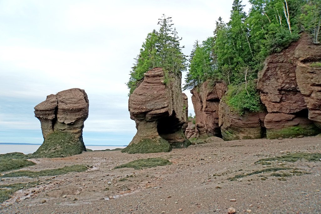
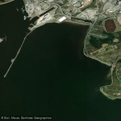
The Bay of Fundy in New Brunswick is a massive, 250-kilometre-long coastal bay renowned for having the highest tides on Earth, with a vertical range reaching up to 42 feet. This extreme tidal phenomenon creates a dynamic and powerful paddling environment that demands respect and careful planning. The water is characterized by its murky, chocolate-brown color due to suspended sediments, and it remains cold year-round, seldom exceeding 7-8°C (44-46°F) even in summer. Paddling here is defined by the dramatic six-hour-and-thirteen-minute tidal cycle, which can see currents moving at speeds around 4.5 km/h, completely submerging and exposing vast intertidal zones twice daily. The coastline features towering red sandstone cliffs, sea caves, narrow passageways, and the iconic Hopewell Rocks—giant flowerpot-shaped formations up to 70 feet tall that paddlers can navigate amongst during high tide.
Key launch points include the Hopewell Rocks Park, where a beach launch provides access to paddle amongst the formations, though an entry fee is required for park access. The fishing village of Alma, near Fundy National Park, is another popular launch area. Guided tours frequently depart from both locations. Due to the cold water, strong currents, and significant wind exposure across the open bay, proper sea kayaks and cold-water safety gear are considered essential; recreational kayaks are widely deemed unsuitable and potentially dangerous for these conditions. The area is a UNESCO Biosphere Reserve, and paddlers can expect to see wildlife such as seals, bald eagles, and vast flocks of migratory shorebirds. The best time for paddling is generally from June through September, with many guided tour operations running during this season.
Water access, boat ramps & amenities
Learn how to get on Bay of Fundy. Uncover great paddling access points, boat ramps, and all the facilities you need for an unforgettable day on the water. Some locations shown may border or include private property. Always check property boundaries and applicable regulations before visiting. PaddleWays's Public & Private Land layer can help you plan your access with confidence.
Paddle smarter with real-time insights
Whether you're en route and conditions shift or you're looking for the best spot based on current flows, we enable you to make informed decisions on the fly.







Nb licenses and regulations
No licenses or regulations available for Nb.
Find Places to Paddle

Over 400,000 Places to Paddle
Every user gets free access to launch points, boat ramps, and public property parcels.


Tides, wind & water conditions (10 day forecast)
On open water, wind and tide matter as much as the weather. See the best times to paddle Bay of Fundy and check the marine forecast before you launch.
Loading tide predictions…
Paddling near Bay of Fundy
Explore Nb waters
Top paddling waters
No waters available right now.
Popular Cities
Loading popular cities...
Explore near Bay of Fundy

Smarter Paddling Starts in the App.
Paddleways gives you everything you need to plan smarter, paddle better, and own every trip from first launch to takeout.