Courtenay Bay
- Saltwater
- Bay
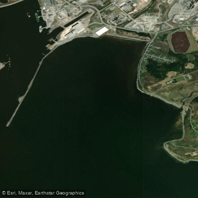
Courtenay Bay
- Saltwater
- Bay
- Sq. miles
- 1.3
- Boat Ramps
- 0
- Access Points
- 0
- Campsites
- 0
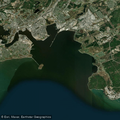
Courtenay Bay is a coastal bay forming part of the Port of Saint John on the Bay of Fundy. It is characterized by its industrial shoreline and significant maritime infrastructure, including a prominent breakwater and breakwater lighthouse. The bay is directly connected to the city's harbor and the St. John River estuary, with Marsh Creek flowing into it over a linear distance of about seven kilometres. The water is saltwater, influenced by the extreme tides of the Bay of Fundy. A primary feature for paddlers is the Courtenay Bay Breakwater, which is a stable structure and presents a potential point of interest. The area has historical significance for shipbuilding, with yards established there in the 19th century. Water quality has been a historical concern, as the City of Saint John has discharged into the connected Marsh Creek system. The overall aesthetic is urban and industrial, dominated by port facilities. The presence of the Canadian Coast Guard's High Endurance Lifeboat CCGC Courtenay Bay indicates active commercial and rescue vessel traffic in the area, which is a major safety consideration for paddlers. There are no specific paddling restrictions. The high level of boat traffic and exposure to the open Bay of Fundy would require significant experience and caution. The best times for paddling would be during calm conditions, and paddlers must be acutely aware of the powerful Fundy tides and currents when planning any route in or near the bay.
Water access, boat ramps & amenities
Learn how to get on Courtenay Bay. Uncover great paddling access points, boat ramps, and all the facilities you need for an unforgettable day on the water. Some locations shown may border or include private property. Always check property boundaries and applicable regulations before visiting. PaddleWays's Public & Private Land layer can help you plan your access with confidence.
Paddle smarter with real-time insights
Whether you're en route and conditions shift or you're looking for the best spot based on current flows, we enable you to make informed decisions on the fly.







Nb licenses and regulations
No licenses or regulations available for Nb.
Find Places to Paddle

Over 400,000 Places to Paddle
Every user gets free access to launch points, boat ramps, and public property parcels.


Tides, wind & water conditions (10 day forecast)
On open water, wind and tide matter as much as the weather. See the best times to paddle Courtenay Bay and check the marine forecast before you launch.
Loading tide predictions…
Paddling near Courtenay Bay
Explore Nb waters
Top paddling waters
No waters available right now.
Popular Cities
Loading popular cities...
Explore near Courtenay Bay

Smarter Paddling Starts in the App.
Paddleways gives you everything you need to plan smarter, paddle better, and own every trip from first launch to takeout.