Bell Island Tickle
- Saltwater
- Strait
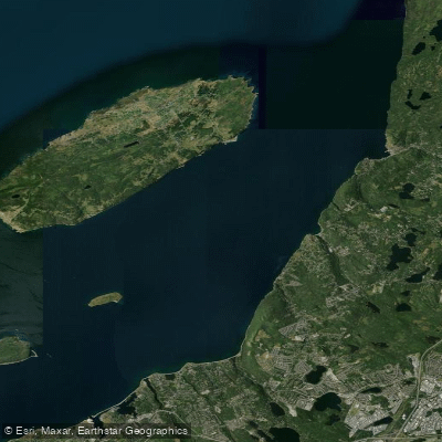
Bell Island Tickle
- Saltwater
- Strait
- Sq. miles
- 29
- Boat Ramps
- 0
- Access Points
- 0
- Campsites
- 0
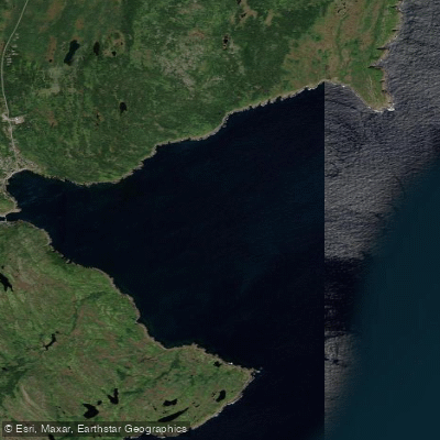
Bell Island Tickle is the strait separating Bell Island from the mainland community of Portugal Cove-St. Philip's in Conception Bay, Newfoundland. This is a classic, exposed saltwater paddling route for intermediate to advanced sea kayakers. The water body is characterized by significant tidal currents, reported to reach up to 1.5 knots, and a reputation for sudden rough water when winds oppose the tide. The coastline on both sides of the tickle is dominated by steep, rocky cliffs tens of meters high, offering a dramatic table mountain-like view from the water. There are very few viable landing spots along these cliffs, with the primary access points being near the Bell Island ferry dock and the beach at Lance Cove. The put-in near the ferry dock on Bell Island is a known launch point, and paddlers often transport their kayaks on the ferry from Portugal Cove.
The paddling experience is defined by powerful swell, especially on the island's northern and western sides, where waves break heavily on shoals and sea cliffs. Notable features along the route include sea caves, natural bridges, and a 100-meter tunnel through the cliffs, though entry can be dangerous due to crashing swell. The southwest coast features prominent sea stacks known as The Bell, Coadys Island, and The Clapper. The waters, particularly between Bell Island and the uninhabited Little Bell Island, are treacherous for shipping due to shallow rocks and shipwrecks, indicating submerged hazards for paddlers. A circumnavigation of Bell Island via the tickle is a popular day trip of approximately 25 kilometers, requiring careful planning around tide stages and wind conditions. The area has historical significance from iron ore mining, with mine tunnels beneath the seabed.
Water access, boat ramps & amenities
Learn how to get on Bell Island Tickle. Uncover great paddling access points, boat ramps, and all the facilities you need for an unforgettable day on the water. Some locations shown may border or include private property. Always check property boundaries and applicable regulations before visiting. PaddleWays's Public & Private Land layer can help you plan your access with confidence.
Paddle smarter with real-time insights
Whether you're en route and conditions shift or you're looking for the best spot based on current flows, we enable you to make informed decisions on the fly.







Nl licenses and regulations
No licenses or regulations available for Nl.
Find Places to Paddle

Over 400,000 Places to Paddle
Every user gets free access to launch points, boat ramps, and public property parcels.


Tides, wind & water conditions (10 day forecast)
On open water, wind and tide matter as much as the weather. See the best times to paddle Bell Island Tickle and check the marine forecast before you launch.
Loading tide predictions…
Explore Nl waters
Top paddling waters
No waters available right now.
Popular Cities
Loading popular cities...
Explore near Bell Island Tickle

Smarter Paddling Starts in the App.
Paddleways gives you everything you need to plan smarter, paddle better, and own every trip from first launch to takeout.