Long Pond
Long Pond
- Boat Ramps
- 0
- Access Points
- 0
- Campsites
- 0
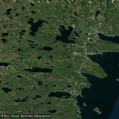
Long Pond is a small freshwater pond located within St. John's, adjacent to the Memorial University of Newfoundland (MUN) campus. The paddleable distance on the main pond is approximately 675 metres, with an additional kilometre or so of round-trip distance available by exploring the marsh on the southwest end, near the Health Sciences Building. That marsh section loops back on itself and adds meaningful variety to what would otherwise be a short outing.
There are two practical launch points. The first is from the MUN parking lot off Morrisey Road, near the Splash Facility, where paddlers have been permitted to park. The second is from the bank off Nagle's Place, at the bottom of the sliding hill, with parking available at the Fluvarium nearby.
The marsh route on the southwest end, toward the Health Sciences Building, is described as a pleasure to explore and provides the bulk of the additional paddling distance beyond the main pond. Paddlers should note that satellite imagery can be misleading about how the marsh channels connect — the route loops within the marsh rather than feeding out toward Prince Philip Drive.
As with all paddling in the region, checking weather conditions before launching is advisable, as wind can create challenging conditions even on small ponds. A PFD for each paddler is recommended, and informing someone of your plans before heading out is standard practice. Water levels can vary with weather conditions.
The pond is considered safe and well-suited to beginner paddlers given its small size and sheltered character. Its location within the city makes it convenient and easily accessible, and it has attracted paddlers including those interested in canoe touring and casual exploration of the adjacent marsh habitat.
Water access, boat ramps & amenities
Learn how to get on Long Pond. Uncover great paddling access points, boat ramps, and all the facilities you need for an unforgettable day on the water. Some locations shown may border or include private property. Always check property boundaries and applicable regulations before visiting. PaddleWays's Public & Private Land layer can help you plan your access with confidence.
Paddle smarter with real-time insights
Whether you're en route and conditions shift or you're looking for the best spot based on current flows, we enable you to make informed decisions on the fly.







Nl licenses and regulations
No licenses or regulations available for Nl.
Find Places to Paddle

Over 400,000 Places to Paddle
Every user gets free access to launch points, boat ramps, and public property parcels.


Water and weather conditions (10 day forecast)
See the best times to paddle Long Pond and check the forecast before you go.
No forecast data available.
Explore Nl waters
Top paddling waters
No waters available right now.
Popular Cities
Loading popular cities...
Explore near Long Pond

Smarter Paddling Starts in the App.
Paddleways gives you everything you need to plan smarter, paddle better, and own every trip from first launch to takeout.