Mobile Big Pond
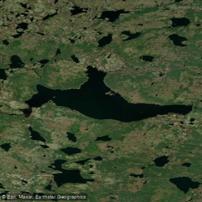
Mobile Big Pond
- Boat Ramps
- 0
- Access Points
- 0
- Campsites
- 0
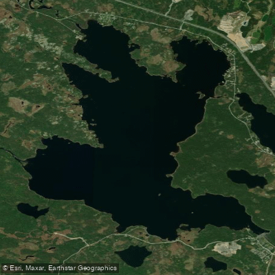
Mobile Big Pond is located approximately 30 minutes south of St. John's, accessible by driving through Bay Bulls, Witless Bay, and then Mobile. From Mobile, look for a convenience store on the left-hand side; 1.3 km past it, a dirt road on the right leads to the pond, roughly 10 km in. The road is passable by vehicle all the way to the water's edge, making access relatively straightforward. The pond's coordinates are approximately 47.272524, -53.026781, placing it in Division No. 1, Newfoundland and Labrador.
The pond has been dammed to power a small hydroelectric station, which means water levels fluctuate. In summer and autumn, levels tend to be lower, exposing significant stretches of shoreline. Paddlers should be aware of this variability when planning a trip, as it can affect launch conditions and the overall character of the water's edge.
A documented paddling route runs from Mobile Big Pond up the Mobile River, heading west and slightly north, with a destination at Madison's Rock and a return trip along the same course. This route has been written up by Peter Armitage and is referenced in the Kayak Newfoundland and Labrador library. The pond sits within a landscape that, like much of the Avalon Peninsula, keeps the ocean relatively close at hand.
The pond supports fishing activity, with catches recorded in the area. Nearby water bodies include Finnies Pond (approximately 5.3 miles away) and Big Triangle Pond (approximately 8.7 miles away). The surrounding terrain involves a mix of beach, river crossings, and rocky outcroppings, giving the area a varied and somewhat rugged character. The shoreline includes large rocks and open beach sections, particularly when water levels are low.
Water access, boat ramps & amenities
Learn how to get on Mobile Big Pond. Uncover great paddling access points, boat ramps, and all the facilities you need for an unforgettable day on the water. Some locations shown may border or include private property. Always check property boundaries and applicable regulations before visiting. PaddleWays's Public & Private Land layer can help you plan your access with confidence.
Paddle smarter with real-time insights
Whether you're en route and conditions shift or you're looking for the best spot based on current flows, we enable you to make informed decisions on the fly.







Nl licenses and regulations
No licenses or regulations available for Nl.
Find Places to Paddle

Over 400,000 Places to Paddle
Every user gets free access to launch points, boat ramps, and public property parcels.


Water and weather conditions (10 day forecast)
See the best times to paddle Mobile Big Pond and check the forecast before you go.
No forecast data available.
Explore Nl waters
Top paddling waters
No waters available right now.
Popular Cities
Loading popular cities...
Explore near Mobile Big Pond

Smarter Paddling Starts in the App.
Paddleways gives you everything you need to plan smarter, paddle better, and own every trip from first launch to takeout.