Manuels River
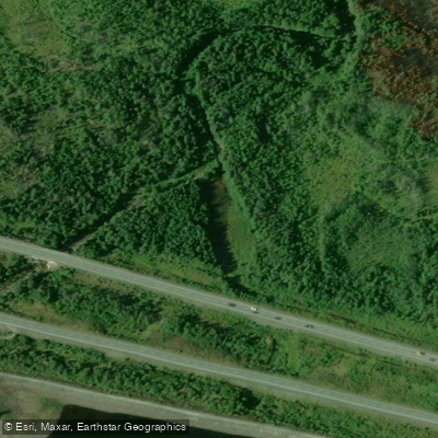
Manuels River
- Boat Ramps
- 0
- Access Points
- 0
- Campsites
- 0
Manuels River is a stream located in Conception Bay South, Newfoundland and Labrador, at approximately 47°32′N 52°57′W. The river connects Thomas Pond upstream to Bubble Pond at its mouth, and paddling opportunities are centered on these two water bodies rather than the river channel itself.
Bubble Pond, the tidal mouth of Manuels River, is accessed from Worsley Park in Manuels. It is a shallow body of water with numerous submerged rocks, making it suitable only for drifting on a SUP, kayak, or canoe rather than covering any meaningful distance. Paddlers on a SUP should exercise particular caution, as moving quickly risks abrupt contact with the bottom. The shallowness does have one benefit: the water warms considerably, making it a pleasant spot to swim. This area is best treated as a calm, slow-water experience rather than a paddling destination for those seeking distance or challenge.
Upstream, Thomas Pond receives the Manuels River and offers a more substantial paddle. The pond has two wide arms and following the shoreline can yield a considerable distance. Its size, however, makes it susceptible to wind, and conditions should be chosen carefully. A dam is present on the pond, and submerged rocks lurk beneath the surface in places, so attentiveness is warranted throughout. A campsite is located where the Manuels River enters Thomas Pond, marked by a tree marker, making it a viable option for a weekend overnight trip. Access to Thomas Pond is from the eastbound Trans-Canada Highway, just east of the Foxtrap Access Road.
The broader Manuels River valley is recognized for its ecological diversity, including varied habitats and a wide assortment of bird species. The area also contains world-renowned fossil sites and is served by the Manuels River Hibernia Interpretation Centre at 7 Conception Bay Highway, which functions as a visitor information centre. The river is also known locally for brown trout, brook trout, and sea trout fishing.
Water access, boat ramps & amenities
Learn how to get on Manuels River. Uncover great paddling access points, boat ramps, and all the facilities you need for an unforgettable day on the water. Some locations shown may border or include private property. Always check property boundaries and applicable regulations before visiting. PaddleWays's Public & Private Land layer can help you plan your access with confidence.
Paddle smarter with real-time insights
Whether you're en route and conditions shift or you're looking for the best spot based on current flows, we enable you to make informed decisions on the fly.







Nl licenses and regulations
No licenses or regulations available for Nl.
Find Places to Paddle

Over 400,000 Places to Paddle
Every user gets free access to launch points, boat ramps, and public property parcels.


Water and weather conditions (10 day forecast)
See the best times to paddle Manuels River and check the forecast before you go.
No forecast data available.
Explore Nl waters
Top paddling waters
No waters available right now.
Popular Cities
Loading popular cities...
Explore near Manuels River

Smarter Paddling Starts in the App.
Paddleways gives you everything you need to plan smarter, paddle better, and own every trip from first launch to takeout.