Bonavista Bay
- Saltwater
- Bay
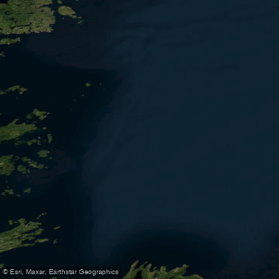
Bonavista Bay
- Saltwater
- Bay
- Sq. miles
- 814
- Boat Ramps
- 0
- Access Points
- 0
- Campsites
- 0
Bonavista Bay is a large coastal bay on the northeast coast of Newfoundland, bordering Terra Nova National Park. The bay features a deeply indented coastline with numerous inlets, secluded bays, and offshore islands, creating a complex and sheltered paddling environment ideal for multi-day expeditions. The area is known for its colourful seascapes, sea caves, and dramatic coastal rock formations. Paddlers can expect to encounter icebergs in the late spring and early summer, along with frequent sightings of whales, dolphins, eagles, and puffins. The water is part of the North Atlantic, meaning conditions are heavily influenced by weather, wind, and tides; paddlers must be prepared for sudden changes and have appropriate coastal touring skills. Several communities around the bay, such as Happy Adventure and Port Rexton, serve as potential launch points and offer basic amenities for paddlers, including accommodations, restaurants, and gear rentals. Specific operators like Happy Adventure Tours provide personalized kayaking adventures, water shuttle services to coastal campsites, and backcountry camping gear rentals, facilitating extended trips. The region's historical significance is evident in the hundreds of isolated former outport communities settled centuries ago along its shores. The best paddling season runs from mid-May through October, with water temperatures remaining cold year-round, necessitating proper immersion protection. The communities mentioned and the Terra Nova National Park Visitor Centre are logical starting points for trip planning.
Water access, boat ramps & amenities
Learn how to get on Bonavista Bay. Uncover great paddling access points, boat ramps, and all the facilities you need for an unforgettable day on the water. Some locations shown may border or include private property. Always check property boundaries and applicable regulations before visiting. PaddleWays's Public & Private Land layer can help you plan your access with confidence.
Paddle smarter with real-time insights
Whether you're en route and conditions shift or you're looking for the best spot based on current flows, we enable you to make informed decisions on the fly.







Nl licenses and regulations
No licenses or regulations available for Nl.
Find Places to Paddle

Over 400,000 Places to Paddle
Every user gets free access to launch points, boat ramps, and public property parcels.


Tides, wind & water conditions (10 day forecast)
On open water, wind and tide matter as much as the weather. See the best times to paddle Bonavista Bay and check the marine forecast before you launch.
Loading tide predictions…
Paddling near Bonavista Bay
Explore Nl waters
Top paddling waters
No waters available right now.
Popular Cities
Loading popular cities...
Explore near Bonavista Bay

Smarter Paddling Starts in the App.
Paddleways gives you everything you need to plan smarter, paddle better, and own every trip from first launch to takeout.