Lake Micmac
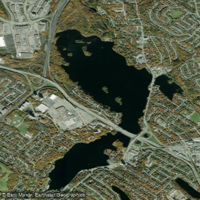
Lake Micmac
- Boat Ramps
- 0
- Access Points
- 0
- Campsites
- 0
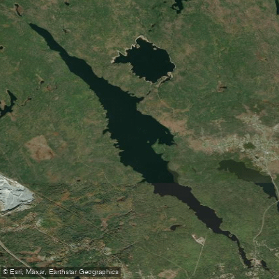
Lake Micmac is located in Dartmouth, Nova Scotia, just north of Lake Banook, to which it is directly connected. The two lakes are collectively referred to as the "Dartmouth Lakes" in historical documents. The lake takes its name from the Mi'kmaq, the indigenous people of Nova Scotia who have paddled its waters for over 10,000 years. Coordinates for the lake are 44°41'33.4"N, 63°33'08.6"W.
Lake Micmac is part of the Shubenacadie Canal Waterway, making it a natural segment of a longer paddling route that runs from Lake Banook northward through Shubie Park and onward through Lake Charles, Lake William, Lake Thomas, Lake Fletcher, Shubenacadie (Grand) Lake, and ultimately the Shubenacadie River toward the Bay of Fundy. Paddlers traveling this route enter Lake Micmac directly from Lake Banook. At the north end of the lake, a small, round artificial island marks the entrance to the canal and Lock 2. To continue north into Shubie Park, a portage around Lock 2 is required; docks are conveniently located on each side of the lock to facilitate this.
A notable safety consideration on Lake Micmac is the presence of water skiers and jet-boats, which requires paddlers to exercise greater caution than on the calmer Lake Banook. Despite this, the lake offers several points of interest, including numerous coves, abundant wildlife, and remnant canal structures from the historic Shubenacadie Canal. The canal's "Deep Cut," the channel connecting Lake Micmac to Lake Charles, was completed in 1829 after three years of construction and represents a significant piece of regional engineering history. The official turning of the sod for the canal took place in 1826 in the forested area just north of the lake, now within Shubie Park.
Public access points exist on the lake, including a boat launch on Waverley Road near a gas station. Canoe Kayak Nova Scotia maintains a detailed interactive map of all public access points on the Shubenacadie Canal Waterway, with full information sheets for each location including available amenities and any restrictions. Lake Banook, the logical starting point for paddling this section of the waterway, offers multiple public boat launch areas and is approximately 1.5 km in length.
Water access, boat ramps & amenities
Learn how to get on Lake Micmac. Uncover great paddling access points, boat ramps, and all the facilities you need for an unforgettable day on the water. Some locations shown may border or include private property. Always check property boundaries and applicable regulations before visiting. PaddleWays's Public & Private Land layer can help you plan your access with confidence.
Paddle smarter with real-time insights
Whether you're en route and conditions shift or you're looking for the best spot based on current flows, we enable you to make informed decisions on the fly.








Find Places to Paddle

Over 400,000 Places to Paddle
Every user gets free access to launch points, boat ramps, and public property parcels.


Water and weather conditions (10 day forecast)
See the best times to paddle Lake Micmac and check the forecast before you go.
No forecast data available.
Paddling near Lake Micmac
Explore Ns waters
Top paddling waters
No waters available right now.
Popular Cities
Loading popular cities...
Explore near Lake Micmac

Smarter Paddling Starts in the App.
Paddleways gives you everything you need to plan smarter, paddle better, and own every trip from first launch to takeout.