St. Margarets Bay
- Saltwater
- Bay
St. Margarets Bay
- Saltwater
- Bay
- Sq. miles
- 47
- Boat Ramps
- 0
- Access Points
- 0
- Campsites
- 0
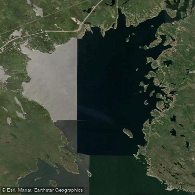
St. Margarets Bay is a coastal bay on the Atlantic coast of Nova Scotia, Canada. The bay's shoreline offers several access points for paddlers. A formal boat launch site is located on Highway 3, approximately three kilometers west of Queensland Beach Provincial Park. Another known entry point is beside Todd Island Road. Bay Lookout Park, located at 7124 St. Margarets Bay Road in Boutiliers Point, is a day-use park with a boat launch administered by the Halifax Regional Municipality and is free to use. The bay is a popular area for recreational boating, including sailing adventures and commercial kayak tours, indicating the presence of other boat traffic that paddlers should be aware of. The bay's character includes a mix of developed shoreline and natural vistas, with one paddling route noted for passing an iconic castle cottage viewpoint and returning along a golden shoreline. The St. Margarets Bay Trail, a 32km stretch of the Rum Runners Trail, runs along the coast, providing potential overland access points and scenic views. For paddlers using their own craft, early morning and evening are great times to be on the water. The bay is a saltwater feature subject to Atlantic Ocean conditions, including tides, winds, and potential swell, which are critical factors for trip planning that paddlers must independently research prior to departure.
Water access, boat ramps & amenities
Learn how to get on St. Margarets Bay. Uncover great paddling access points, boat ramps, and all the facilities you need for an unforgettable day on the water. Some locations shown may border or include private property. Always check property boundaries and applicable regulations before visiting. PaddleWays's Public & Private Land layer can help you plan your access with confidence.
Paddle smarter with real-time insights
Whether you're en route and conditions shift or you're looking for the best spot based on current flows, we enable you to make informed decisions on the fly.








Find Places to Paddle

Over 400,000 Places to Paddle
Every user gets free access to launch points, boat ramps, and public property parcels.


Tides, wind & water conditions (10 day forecast)
On open water, wind and tide matter as much as the weather. See the best times to paddle St. Margarets Bay and check the marine forecast before you launch.
Loading tide predictions…
Paddling near St. Margarets Bay
Explore Ns waters
Top paddling waters
No waters available right now.
Popular Cities
Loading popular cities...
Explore near St. Margarets Bay

Smarter Paddling Starts in the App.
Paddleways gives you everything you need to plan smarter, paddle better, and own every trip from first launch to takeout.