Pockwock Lake
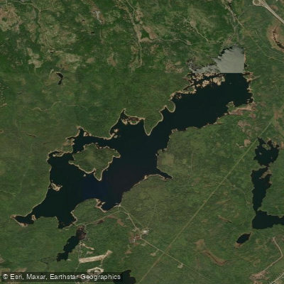
Pockwock Lake
- Boat Ramps
- 0
- Access Points
- 0
- Campsites
- 0
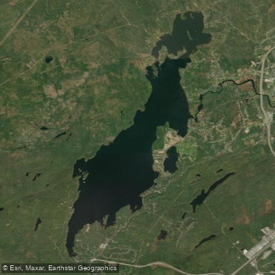
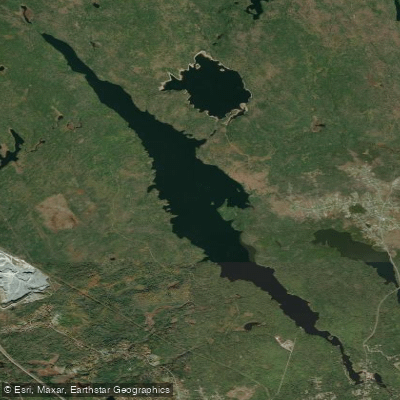
Pockwock Lake is a glacial lake straddling Halifax County and Hants County in Nova Scotia, measuring approximately 6.96 kilometres in length and 2.28 kilometres in width. It contains four named islands — Haverstock Island, Sand Cove Island, Pompeys Island, and Upper Pompeys Island — and is connected to Little Pockwock Lake by a stream. The lake serves as a primary drinking water source managed by Halifax Water.
Paddlers should be aware that boating is restricted within the protected and managed watershed areas that encompass Pockwock Lake. There are no public boat launches on the lake. Swimming, bathing, and washing are prohibited at all times in the lake and any tributaries within the Protected Water Area, and fishing is similarly not permitted under Pockwock regulations. These restrictions exist to protect the municipal water supply, and Halifax Water actively enforces them through signage, fencing, security cameras, and regular patrols.
The lake is accessible via Nova Scotia Route 213 and Route 101, as well as several minor forest trails, but access for recreational water use is not sanctioned within the protected watershed. Water quality monitoring conducted between 2006 and 2008 recorded pH values ranging from approximately 4.8 to 5.5, indicating notably acidic conditions, with additional concerns around aluminum, manganese, and turbidity levels.
Given the active restrictions on boating and the absence of public launch infrastructure, Pockwock Lake is not a suitable destination for recreational paddling. Those seeking paddling opportunities in the broader Halifax region should look to nearby water bodies outside protected watershed designations.
Water access, boat ramps & amenities
Learn how to get on Pockwock Lake. Uncover great paddling access points, boat ramps, and all the facilities you need for an unforgettable day on the water. Some locations shown may border or include private property. Always check property boundaries and applicable regulations before visiting. PaddleWays's Public & Private Land layer can help you plan your access with confidence.
Paddle smarter with real-time insights
Whether you're en route and conditions shift or you're looking for the best spot based on current flows, we enable you to make informed decisions on the fly.








Find Places to Paddle

Over 400,000 Places to Paddle
Every user gets free access to launch points, boat ramps, and public property parcels.


Water and weather conditions (10 day forecast)
See the best times to paddle Pockwock Lake and check the forecast before you go.
No forecast data available.
Paddling near Pockwock Lake
Explore Ns waters
Top paddling waters
No waters available right now.
Popular Cities
Loading popular cities...
Explore near Pockwock Lake

Smarter Paddling Starts in the App.
Paddleways gives you everything you need to plan smarter, paddle better, and own every trip from first launch to takeout.