Orwell Bay
- Saltwater
- Bay
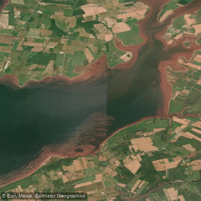
Orwell Bay
- Saltwater
- Bay
- Sq. miles
- 6.6
- Boat Ramps
- 0
- Access Points
- 0
- Campsites
- 0
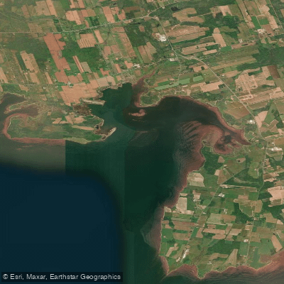
Orwell Bay is a coastal bay on the southern shore of Prince Edward Island, Canada, opening into the Northumberland Strait. The bay is characterized by its dramatic red sandstone cliffs, which are among the highest on the island, reaching approximately 35 meters in elevation. This creates a striking, steep shoreline in areas, particularly noted along the stretch from Murray Head past High Bank. The bay's entrance at Point Prim is a significant navigational feature, marked by the island's oldest conical lighthouse. This point is known for potentially hazardous conditions for paddlers, as long, sharp ledges extend into the strait. During ebb tides, a strong outflow current from Orwell Bay can create a confused and breaking tidal rip, especially when combined with westerly winds, requiring advanced paddling skills to navigate.
Access for launching is available from several points around the bay, including public wharves at MacAulays and Pinette, as well as beaches at Keppoch Road, Tea Hill Park, and Pinette Day Use Provincial Park. Lord Selkirk Park, the historic anchorage for early settlers, also provides shoreline access. The area is exposed to the fetch of the Northumberland Strait, making wind and wave conditions a primary consideration. Paddlers must be particularly mindful of the strong tidal currents at the bay's mouth near Point Prim and plan crossings with the tide stages. The bay sees boat traffic, and the entrance is adjacent to a major ferry route at Wood Islands, necessitating vigilance.
The surrounding region is rich in Scottish settlement history, with sights like the Croft House Selkirk Heritage Centre and St. John's Presbyterian Church visible from the water. The pastoral and cliff-side scenery is a key attraction. The Northumberland Strait is known for cool waters, and paddlers should prepare for marine conditions. Facilities are limited directly on the water, but the nearby Orwell Corner Historic Village and various parks offer amenities. The overall paddling experience offers a mix of open coastal challenge near the entrance and more protected exploration within the bay, set against a backdrop of high red cliffs and agricultural land.
Water access, boat ramps & amenities
Learn how to get on Orwell Bay. Uncover great paddling access points, boat ramps, and all the facilities you need for an unforgettable day on the water. Some locations shown may border or include private property. Always check property boundaries and applicable regulations before visiting. PaddleWays's Public & Private Land layer can help you plan your access with confidence.
Paddle smarter with real-time insights
Whether you're en route and conditions shift or you're looking for the best spot based on current flows, we enable you to make informed decisions on the fly.







Pe licenses and regulations
No licenses or regulations available for Pe.
Find Places to Paddle

Over 400,000 Places to Paddle
Every user gets free access to launch points, boat ramps, and public property parcels.


Tides, wind & water conditions (10 day forecast)
On open water, wind and tide matter as much as the weather. See the best times to paddle Orwell Bay and check the marine forecast before you launch.
Loading tide predictions…
Paddling near Orwell Bay
Explore Pe waters
Top paddling waters
No waters available right now.
Popular Cities
Loading popular cities...
Explore near Orwell Bay

Smarter Paddling Starts in the App.
Paddleways gives you everything you need to plan smarter, paddle better, and own every trip from first launch to takeout.