Rollo Bay
- Saltwater
- Bay
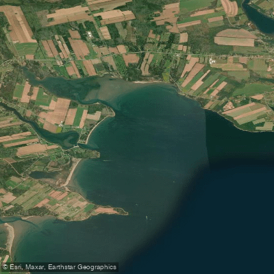
Rollo Bay
- Saltwater
- Bay
- Sq. miles
- 5.9
- Boat Ramps
- 0
- Access Points
- 0
- Campsites
- 0
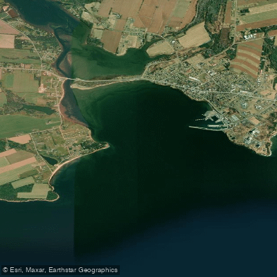
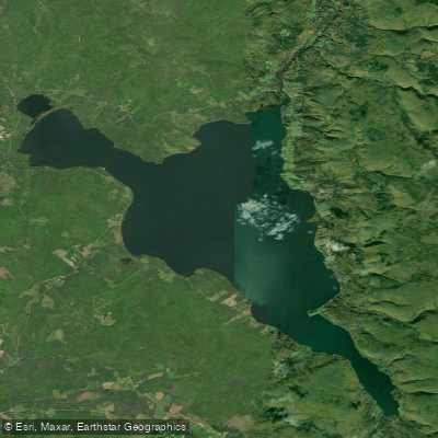
Rollo Bay is a coastal bay on the eastern shore of Prince Edward Island, forming part of the Northumberland Strait. Its most defining geographical feature is the expansive Rollo Bay Flats, a large intertidal area that extends from Lower Rollo Bay to Fortune. At low tide, these flats are exposed, creating a broad, shallow landscape that historically provided a low-tide shortcut and winter ice road between communities. This extensive tidal zone is a critical consideration for paddlers, as it dictates that trips must be carefully planned around the tide. Paddling is only practical during mid to high tide stages; at low tide, large areas become impassable mud and sand flats. A colony of seals is known to rest on these flats at low tide. The bay's open exposure to the Northumberland Strait means conditions are highly dependent on wind and weather, with the potential for significant fetch and wave action, particularly from easterly or southerly winds. The area is used by local fishermen, so paddlers should be aware of boat traffic, especially near channel markers and buoys.
Paddlers access the bay from the shoreline communities. The bay is used as a crossing point for longer coastal journeys, such as the route from Souris Head to Howe Point, Durrell Point, and Spry Point. The aesthetic is characterized by open water, distant horizons, and a quiet, often profound solitude punctuated by the sights and sounds of working harbors. The water's appearance can shift dramatically with light and weather, from liquid silver to cobalt blue. The surrounding sandstone cliffs and beaches provide scenic backdrops. The area has deep Acadian cultural roots, evident in historical sites like the St. Alexis Mission pioneer cemetery. The community is famously musical, home to the long-running Rollo Bay Fiddle Festival, whose grounds are a local gathering place. Paddling is best undertaken in the calm, warmer summer months, with water temperatures in the Northumberland Strait becoming most comfortable from July through September. No specific paddling restrictions exist, but general right-of-way rules and respect for private property apply.
Water access, boat ramps & amenities
Learn how to get on Rollo Bay. Uncover great paddling access points, boat ramps, and all the facilities you need for an unforgettable day on the water. Some locations shown may border or include private property. Always check property boundaries and applicable regulations before visiting. PaddleWays's Public & Private Land layer can help you plan your access with confidence.
Paddle smarter with real-time insights
Whether you're en route and conditions shift or you're looking for the best spot based on current flows, we enable you to make informed decisions on the fly.







Pe licenses and regulations
No licenses or regulations available for Pe.
Find Places to Paddle

Over 400,000 Places to Paddle
Every user gets free access to launch points, boat ramps, and public property parcels.


Tides, wind & water conditions (10 day forecast)
On open water, wind and tide matter as much as the weather. See the best times to paddle Rollo Bay and check the marine forecast before you launch.
Loading tide predictions…

Explore Pe waters
Top paddling waters
No waters available right now.
Popular Cities
Loading popular cities...
Explore near Rollo Bay

Smarter Paddling Starts in the App.
Paddleways gives you everything you need to plan smarter, paddle better, and own every trip from first launch to takeout.