Meeting Lake
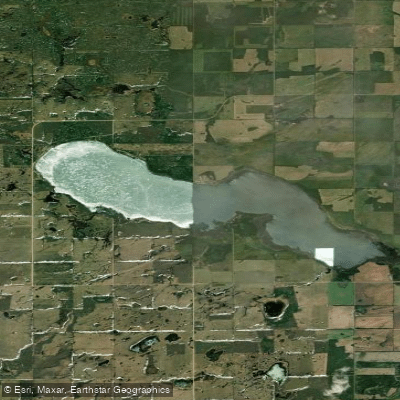
Meeting Lake
- Boat Ramps
- 0
- Access Points
- 0
- Campsites
- 0
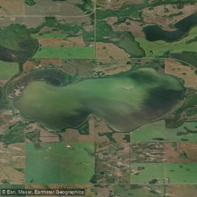
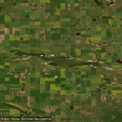
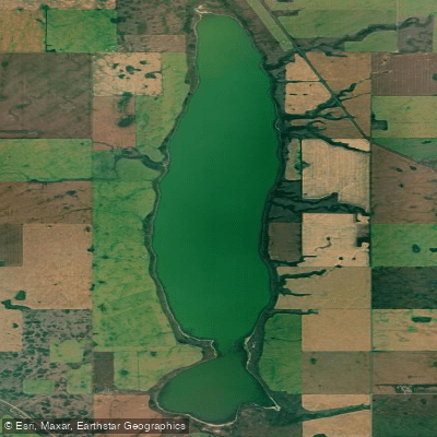
Meeting Lake is a large, shallow freshwater lake covering approximately 2,733 acres (1,108 hectares) in west-central Saskatchewan, located about 22 kilometres south-southwest of Spiritwood and 63 kilometres northeast of North Battleford. The lake sits at an elevation of 739 metres and has a maximum depth of 13 metres, with a shoreline stretching roughly 20.8 kilometres. It is an endorheic lake, meaning it has no natural outlet, and water levels have been rising significantly in recent years, resulting in flooding to cabins and the Regional Park — a factor paddlers should be aware of when planning access.
Highway 378 runs near the south shore and provides the primary road access to the lake. The Meeting Lake Regional Park on the western shore offers the most developed infrastructure for paddlers, including a boat launch and marina. The boat launch carries a daily fee of $10 or a seasonal fee of $30. The park also provides camping with electrical sites, showers, laundry, a store, gasoline service, and a sewer dump station, making it a practical base for multi-day trips. Four communities are situated around the lake: Spruce Bay and Moose Range on the northeast shore, and the hamlets of Crescent Beach and Shady Bay on the south shore.
Paddlers should note that parts of the northeast shore fall within the Mosquito Grizzly Bear's Head Lean Man Treaty Land Entitlement Reserve. According to Saskatchewan regulations, permission from the First Nation Chief or Band Council is required to access or fish on First Nations reserve lands, so paddlers exploring the northeast portion of the lake should be mindful of these boundaries.
The lake supports populations of Walleye, Northern Pike, Yellow Perch, and White Sucker, with Walleye periodically stocked as fry. The area carries historical and cultural significance: prior to European settlement, the lake was known as a Meeting Place for local Indigenous peoples, and during the North-West Rebellion it was reportedly the site of a brief encounter between the Métis and the North-West Mounted Police.
The lake is classified within Saskatchewan's southern fishing zone, with the fishing season running from early May through late March of the following year, which broadly reflects the ice-free paddling window in this part of the province.
Water access, boat ramps & amenities
Learn how to get on Meeting Lake. Uncover great paddling access points, boat ramps, and all the facilities you need for an unforgettable day on the water. Some locations shown may border or include private property. Always check property boundaries and applicable regulations before visiting. PaddleWays's Public & Private Land layer can help you plan your access with confidence.
Paddle smarter with real-time insights
Whether you're en route and conditions shift or you're looking for the best spot based on current flows, we enable you to make informed decisions on the fly.








Find Places to Paddle

Over 400,000 Places to Paddle
Every user gets free access to launch points, boat ramps, and public property parcels.


Water and weather conditions (10 day forecast)
See the best times to paddle Meeting Lake and check the forecast before you go.
No forecast data available.
Paddling near Meeting Lake
Explore Sk waters
Top paddling waters
No waters available right now.
Popular Cities
Loading popular cities...
Explore near Meeting Lake

Smarter Paddling Starts in the App.
Paddleways gives you everything you need to plan smarter, paddle better, and own every trip from first launch to takeout.