Rauoterangi Channel
- Saltwater
- Channel
Rauoterangi Channel
- Saltwater
- Channel
- Sq. miles
- 18
- Boat Ramps
- 0
- Access Points
- 0
- Campsites
- 0
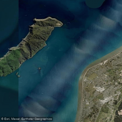
The Rauoterangi Channel is the stretch of coastal water separating Kapiti Island from the mainland of New Zealand's North Island, roughly between Paekākāriki and Waikanae. This channel is a significant coastal paddling route, named in honour of the historic 11km swim by Kahe Te Rau-o-te-rangi. For paddlers, the channel offers a relatively protected route when compared to the open Tasman Sea west of Kapiti Island. A practical long-distance route runs from Pukerua Bay, following the coastline north past Raumati Beach, through the Rauoterangi Channel, and continuing beyond the northern tip of Kapiti Island to beaches like Ōtaki and Waikawa. Key public access points for launching or landing along this route include Pukerua Bay, Raumati Beach, and Ōtaki Beach, with roadside lay-bys providing potential support vehicle stops.
Tidal currents are a primary consideration for trip planning. Paddlers report experiencing an ebb flow working against them while transiting the channel, indicating that timing a paddle to coincide with a flooding (incoming) tide is advantageous for northbound travel. The channel's position in the lee of Kapiti Island often provides calm, flat sea conditions, a sharp contrast to the reasonable swell and occasional large wave sets encountered immediately north of the island where the open coast exposure begins. This makes the channel itself a comparatively sheltered section, though wind against tide conditions can still create challenging chop. The coastline within the channel is characterized by sandy beaches and proximity to State Highway 1. Hazards include the need for careful navigation to account for current drift, with one account noting a miscalculation requiring a strenuous paddle back up-current along a reef. The area is also known for its kelp beds and reefs, which can be navigation hazards at low tide but also indicate a healthy marine ecosystem. Water depth at stream mouths like Waikawa can be very shallow at low tide, complicating landings.
Water access, boat ramps & amenities
Learn how to get on Rauoterangi Channel. Uncover great paddling access points, boat ramps, and all the facilities you need for an unforgettable day on the water. Some locations shown may border or include private property. Always check property boundaries and applicable regulations before visiting. PaddleWays's Public & Private Land layer can help you plan your access with confidence.
Paddle smarter with real-time insights
Whether you're en route and conditions shift or you're looking for the best spot based on current flows, we enable you to make informed decisions on the fly.







Wellington licenses and regulations
No licenses or regulations available for Wellington.
Find Places to Paddle

Over 400,000 Places to Paddle
Every user gets free access to launch points, boat ramps, and public property parcels.


Tides, wind & water conditions (10 day forecast)
On open water, wind and tide matter as much as the weather. See the best times to paddle Rauoterangi Channel and check the marine forecast before you launch.
Loading tide predictions…
Paddling near Rauoterangi Channel
Waikanae River
Ōtaki River
Te Moana-o-Raukawa / Cook Strait
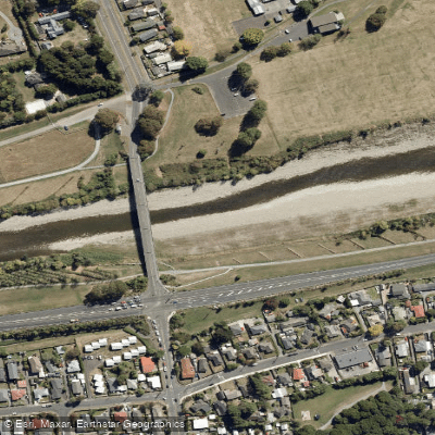
Te Awa Kairangi / Hutt River
Tauwharenīkau River
Waiohine River
Waingawa River
South Taranaki Bight
Mangahao River
Explore Wellington waters
Top paddling waters
No waters available right now.
Popular Cities
Loading popular cities...
Explore near Rauoterangi Channel

Smarter Paddling Starts in the App.
Paddleways gives you everything you need to plan smarter, paddle better, and own every trip from first launch to takeout.