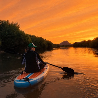
Dona jo M.
660 cfs at Stewart Mountain Dam
Blue Point Picnic Area Access to Phon D Sutton Recreation Area
Curated by PaddleWays
11.7 mi flatwater route on the Salt River in Arizona
Level right now
Recommended level from American Whitewater, on the gauge at Stewart Mountain Dam.
Route facts
Kayakers cannot continue past Granite Reef Dam
About this route
The Lower Salt River is a popular paddling destination in Arizona, offering an 11.7-mile refreshing escape from the desert heat. This section is well-suited for beginners and those looking for a relaxing experience.
The river is accessible year-round, but flow rates can vary depending on dam releases, so it's essential to check current conditions before your trip.
The best time to paddle is generally from April through October, with early morning on weekdays being ideal to avoid crowds.
Paddlers should be aware that the last quarter mile before the Granite Reef Dam flows particularly slow and widens considerably, creating more of a lake-like environment. Kayakers cannot continue past Granite Reef Dam.
Put-in and take-out
Hazards
No paddler has reported a hazard here yet, so these are the dams, falls and big rapids on our map. Hazards change with flows and storms, so check them before you launch.
Hazard
Easy access point below parking lot (need parking pass)
From the community
Real trips from PaddleWays paddlers who ran this route: how the flows were, and what to watch for.
Loading trip reports
Dona jo M.
660 cfs at Stewart Mountain Dam
Blue Point Picnic Area Access to Phon D Sutton Recreation Area
The gauges near Lower Salt River and the forecast where it starts, so you can pick your day.
No forecast data available.
Same water
The other curated routes on the Salt River, each with how it is running now.
RouteClass III–IV
RouteClass IV
Close by
Curated routes on other waters within an hour or so, nearest first.
on Verde River · 12 mi away
RouteClass I–II
on Verde River · 26 mi away
RouteClass I–II
on Tonto Creek · 33 mi away
RouteClass III–V
on Gila River · 40 mi away
RouteFlatwater
on Verde River · 44 mi away
RouteClass III–IV
on Agua Fria River · 48 mi away
RouteClass III–IV
PaddleWays gives you everything you need to plan smarter, paddle better, and own every trip from first launch to takeout.
