Cibola Lake
- Lake
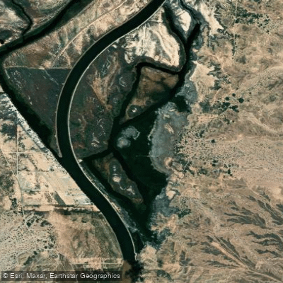
Cibola Lake
- Lake
- Public shoreline
- 0%
- Boat Ramps
- 0
- Access Points
- 0
Cibola Lake is part of the Cibola National Wildlife Refuge along the Lower Colorado River. Paddling is permitted from March 15 through September 30, but the lake is completely closed to entry from October 1 through March 14. Only electric trolling motors and manually powered vessels are allowed, and the entire lake is designated as a no-wake zone.
The lake serves an important ecological role, having been established in 1964 to mitigate habitat loss from Colorado River channelization. The surrounding refuge encompasses historic marshes and backwaters that provide critical wintering grounds for migratory waterfowl.
Access is via designated boat ramps only, and all watercraft must be launched from these official points. Paddlers must follow specific regulations: - No overnight mooring or attaching boats to vegetation - Vehicles must stay on designated roads with a 25 mph speed limit - Life jackets are required for all vessel occupants - No camping or fires are permitted - Valid state fishing license required if fishing
Key facilities include designated parking areas and boat ramps, though specific amenity details are limited. The lake environment features marsh habitat and restored river backwaters characteristic of the lower Colorado River ecosystem.
The refuge provides opportunities for wildlife viewing and photography, with various waterfowl species present seasonally. Located near the small farming community of Cibola, the lake is accessible from Blythe, CA by traveling approximately 3 miles west on I-10 to Neighbours Boulevard/78, then south 12 miles to the Cibola Bridge, and another 3.5 miles south to the refuge headquarters.
Hazards
Hazards on Cibola Lake
No hazards are marked on Cibola Lake yet. That is not the same as none being there: if you find one, report it for the next paddler.
From the community
Cibola Lake trip reports
Nobody has shared a trip on Cibola Lake yet. Paddle it, then tell the next paddler how it went.
Water access & public shoreline
See exactly where the public can get on and off the water. Launch points and boat ramps are paired with PaddleWays' public land data so you know where you can legally land.
Public shoreline
0%of the lake's shoreline is public
- Public
- 0%
- Private
- 100%
Most of the shoreline is private. Launch, land and camp only at public access points.
Paddling conditions (10 day forecast)
Weather and wind, so you know what to expect on Cibola Lake today.
No forecast data available.
Paddle smarter with real-time insights
Live flows, marked hazards and fresh trip reports from paddlers who were just on the water, all in one place.







Find Places to Paddle

Over 400,000 Places to Paddle
Every user gets free access to launch points, boat ramps, and public property parcels.



Paddling near Cibola Lake
Explore Arizona waters
Top paddling waters
Popular Cities
Loading popular cities...
Explore near Cibola Lake
Access points
Nearby waters
More in Arizona

Smarter Paddling Starts in the App.
PaddleWays gives you everything you need to plan smarter, paddle better, and own every trip from first launch to takeout.